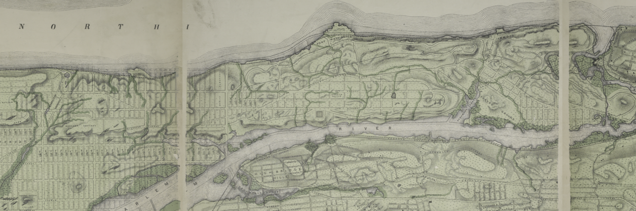
File:Topographical atlas of the city of New York, including the annexed territory showing original water courses and made land. NYPL1527362 (cropped for Northern Manhattan).tif
Jump to navigation
Jump to search

Size of this PNG preview of this TIF file: 799 × 265 pixels. Other resolutions: 320 × 106 pixels | 640 × 212 pixels | 1,024 × 340 pixels | 1,280 × 425 pixels | 2,560 × 849 pixels | 7,592 × 2,519 pixels.
Original file (7,592 × 2,519 pixels, file size: 72.96 MB, MIME type: image/tiff)
File history
Click on a date/time to view the file as it appeared at that time.
| Date/Time | Thumbnail | Dimensions | User | Comment | |
|---|---|---|---|---|---|
| current | 20:34, 6 February 2021 | 7,592 × 2,519 (72.96 MB) | commons>The Spirit of Oohoowahoo | Uploaded a work by Egbert L. (Egbert Ludovicus), 1825-1902 -- Cartographer Viele from http://digitalgallery.nypl.org/nypldigital/dgkeysearchdetail.cfm?imageID=1527362 with UploadWizard |
File usage
There are no pages that use this file.