File:Map -- location of barrages at the mouth of the River Murray.tif
Jump to navigation
Jump to search

Size of this PNG preview of this TIF file: 800 × 478 pixels. Other resolutions: 320 × 191 pixels | 640 × 382 pixels | 1,024 × 611 pixels | 1,280 × 764 pixels | 2,338 × 1,396 pixels.
Original file (2,338 × 1,396 pixels, file size: 12.45 MB, MIME type: image/tiff)
File history
Click on a date/time to view the file as it appeared at that time.
| Date/Time | Thumbnail | Dimensions | User | Comment | |
|---|---|---|---|---|---|
| current | 00:49, 4 March 2021 | 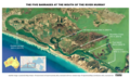 | 2,338 × 1,396 (12.45 MB) | commons>SCHolar44 | Uploaded a work by Government of South Australia (Location SA Map Viewer) from http://location.sa.gov.au/viewer/ with UploadWizard |
File usage
There are no pages that use this file.