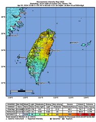
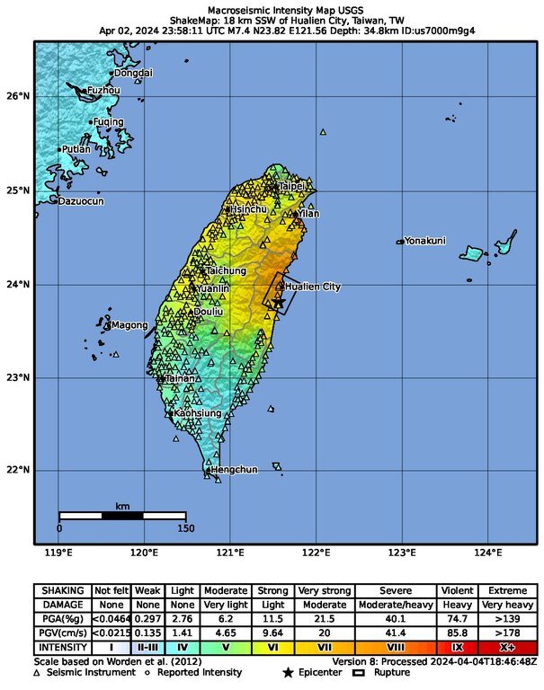
File:Macroseismic Intensity Map USGS ShakeMap 18 km SSW of Hualien City, Taiwan, TW Apr 02, 2024 M7.4.pdf
Jump to navigation
Jump to search

Size of this JPG preview of this PDF file: 472 × 599 pixels. Other resolutions: 189 × 240 pixels | 378 × 480 pixels | 605 × 768 pixels | 1,231 × 1,562 pixels.
Original file (1,231 × 1,562 pixels, file size: 2.21 MB, MIME type: application/pdf)
File history
Click on a date/time to view the file as it appeared at that time.
| Date/Time | Thumbnail | Dimensions | User | Comment | |
|---|---|---|---|---|---|
| current | 03:20, 4 June 2024 |  | 1,231 × 1,562 (2.21 MB) | commons>Sapiann | Version 11: Processed 2024-05-09T23:30:30Z |
File usage
There are no pages that use this file.