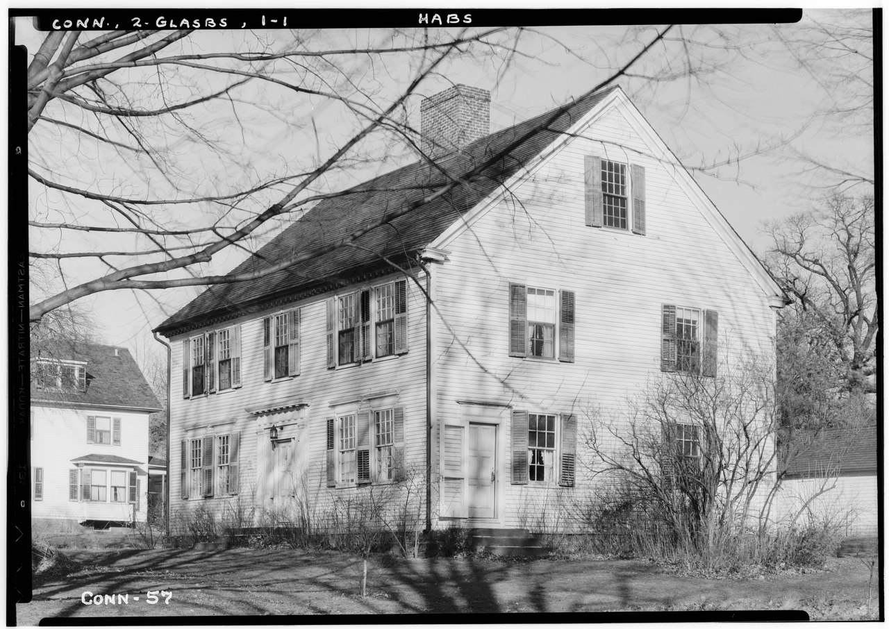
File:Historic American Buildings Survey Everett H. Keeler, Photographer December 6, 1937 SOUTHWEST ELEVATION - Welles-Shipman House, Station Street, South Glastonbury, Hartford HABS CONN,2-GLASBS,1-1.tif

From WikiProjectMed
Jump to navigation Jump to search

Original file(5,000 × 3,538 pixels, file size: 16.87 MB, MIME type: image/tiff)

This file is from a shared repository and may be used by other projects. The description on its file description page there is shown below.

Summary

This is an image of a place or building that is listed on the National Register of Historic Places in the United States of America. Its reference number is 77001418.

Historic American Buildings Survey Everett H. Keeler, Photographer December 6, 1937 SOUTHWEST ELEVATION - Welles-Shipman House, Station Street, South Glastonbury, Hartford County, CT
Title
Historic American Buildings Survey Everett H. Keeler, Photographer December 6, 1937 SOUTHWEST ELEVATION - Welles-Shipman House, Station Street, South Glastonbury, Hartford County, CT
Depicted place Connecticut; Hartford County; South Glastonbury
Dimensions 5 x 7 in.
Current location
Library of Congress Prints and Photographs Division Washington, D.C. 20540 USA http://hdl.loc.gov/loc.pnp/pp.print
Accession number
HABS CONN,2-GLASBS,1-1
Credit line
This file comes from the Historic American Buildings Survey (HABS), Historic American Engineering Record (HAER) or Historic American Landscapes Survey (HALS). These are programs of the National Park Service established for the purpose of documenting historic places. Records consist of measured drawings, archival photographs, and written reports.

This tag does not indicate the copyright status of the attached work. A normal copyright tag is still required. See Commons:Licensing.

Source https://www.loc.gov/pictures/item/ct0126.photos.023088p
Permission
(Reusing this file)
Public domain This image or media file contains material based on a work of a National Park Service employee, created as part of that person's official duties. As a work of the U.S. federal government, such work is in the public domain in the United States. See the NPS website and NPS copyright policy for more information.
Camera location41° 40′ 00.98″ N, 72° 35′ 49.99″ W Kartographer map based on OpenStreetMap.View this and other nearby images on: OpenStreetMapinfo

Captions

Add a one-line explanation of what this file represents

Items portrayed in this file

depicts

41°40'0.98"N, 72°35'49.99"W

image/tiff

File history

Click on a date/time to view the file as it appeared at that time.

Date/TimeThumbnailDimensionsUserComment
current13:34, 7 July 2014Thumbnail for version as of 13:34, 7 July 20145,000 × 3,538 (16.87 MB)commons>FæGWToolset: Creating mediafile for Fæ. HABS 06 July 2014 (611:700)

There are no pages that use this file.

Metadata