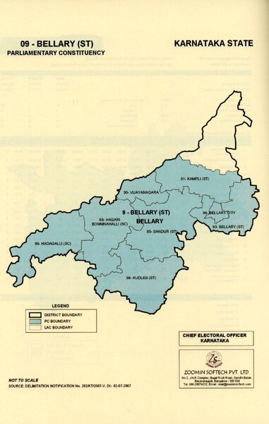
File:Ballari Lok Sabha Constituency Map with district boundary (2009 - Present).pdf
Jump to navigation
Jump to search
Size of this JPG preview of this PDF file: 381 × 600 pixels. Other resolutions: 152 × 240 pixels | 305 × 480 pixels | 1,016 × 1,600 pixels.
Original file (1,016 × 1,600 pixels, file size: 312 KB, MIME type: application/pdf)
File history
Click on a date/time to view the file as it appeared at that time.
| Date/Time | Thumbnail | Dimensions | User | Comment | |
|---|---|---|---|---|---|
| current | 23:41, 2 September 2023 |  | 1,016 × 1,600 (312 KB) | commons>Vijethnbharadwaj | Uploaded a work by Election commission of India from https://www.ceokarnataka.kar.nic.in/pdfs/elections/Karnataka-parlimentary%20map.pdf with UploadWizard |
File usage
There are no pages that use this file.