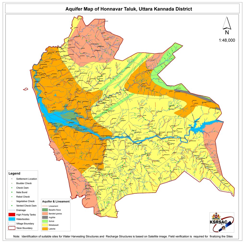
File:Aquifer Map of Honnavar Taluk.pdf
Jump to navigation
Jump to search

Size of this JPG preview of this PDF file: 600 × 600 pixels. Other resolutions: 240 × 240 pixels | 480 × 480 pixels | 768 × 768 pixels | 1,024 × 1,024 pixels | 2,048 × 2,048 pixels | 5,400 × 5,400 pixels.
Original file (5,400 × 5,400 pixels, file size: 2.15 MB, MIME type: application/pdf)
File history
Click on a date/time to view the file as it appeared at that time.
| Date/Time | Thumbnail | Dimensions | User | Comment | |
|---|---|---|---|---|---|
| current | 17:55, 15 October 2021 |  | 5,400 × 5,400 (2.15 MB) | commons>Vijethnbharadwaj | Uploaded a work by Department of Personnel and Administrative Reforms (e-Governance), Government of Karnataka from https://kgis.ksrsac.in/kgisdocuments/TankRSPDF/Uttara%20Kannada/05487.pdf with UploadWizard |
File usage
There are no pages that use this file.