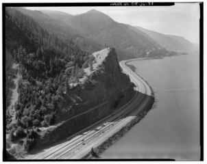
File:AERIAL VIEW OF MITCHELL POINT. HISTORIC COLUMBIA RIVER HIGHWAY ON SIDE OF CLIFF. - Historic Columbia River Highway, Troutdale, Multnomah County, OR HAER ORE,26-TROUT.V,1-79.tif
Jump to navigation
Jump to search

Size of this JPG preview of this TIF file: 753 × 599 pixels. Other resolutions: 302 × 240 pixels | 603 × 480 pixels | 965 × 768 pixels | 1,280 × 1,019 pixels | 2,560 × 2,037 pixels | 5,000 × 3,979 pixels.
Original file (5,000 × 3,979 pixels, file size: 18.98 MB, MIME type: image/tiff)
File history
Click on a date/time to view the file as it appeared at that time.
| Date/Time | Thumbnail | Dimensions | User | Comment | |
|---|---|---|---|---|---|
| current | 08:38, 2 August 2014 |  | 5,000 × 3,979 (18.98 MB) | commons>Fæ | GWToolset: Creating mediafile for Fæ. HABS 2014-08-01 2601-2900 missing |
File usage
There are no pages that use this file.