Dattagalli
Dattagalli | |
|---|---|
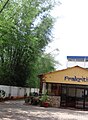
 Temple at Dattagalli bus terminus, Mysore | |
| Coordinates: 12°17′06″N 76°36′07″E / 12.28512°N 76.60187°E | |
| Country | India |
| State | Karnataka |
Dattagalli is a residential area on the southeast of the city of Mysore, the second largest city in the state of Karnataka, India.
Location
Dattagalli is situated around the outer ring road and it is near to Kuvempu Nagar and Andolana Circle. Mysore Airport is 10 km away from Dattagalli. Some famous landmarks here are SaRa Convention Hall, More Supermarket & Nalapak Restaurant.
Education
There are three prominent schools in this area, the Kautilya Vidyalaya (12°16′28″N 76°36′39″E / 12.274306°N 76.610927°E),Christ public school and the Supreme Public School (12°16′42″N 76°36′34″E / 12.278325°N 76.609447°E). One Ayurvedic Hospital (12°17′51″N 6°39′15″E / 12.297596°N 6.6542°E) is also situated in Dattagalli.
See also
Image Gallery
-
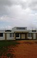
 Kautilya school
 -
 Rotary School
 -
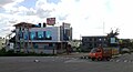 Somanath Road
 -
 Nethaji Circle


12°18′25″N 76°37′18″E / 12.306897°N 76.621685°E
This article related to a location in Mysore district, Karnataka, India is a stub. You can help Wikipedia by expanding it. |
- Pages using gadget WikiMiniAtlas
- Use dmy dates from June 2017
- Use Indian English from June 2017
- All Wikipedia articles written in Indian English
- Articles lacking sources from February 2011
- All articles lacking sources
- Articles with short description
- Short description matches Wikidata
- Pages using infobox settlement with no map
- Coordinates on Wikidata
- Mysore South
- Suburbs of Mysore
- All stub articles
- Mysore district geography stubs