Dale, Oklahoma
Dale | |
|---|---|
| Motto: "Go Dale" | |
 Dale Location within the state of Oklahoma  Dale Dale (the United States) | |
| Coordinates: 35°23′03″N 97°02′36″W / 35.38417°N 97.04333°W | |
| Country | United States |
| State | Oklahoma |
| County | Pottawatomie |
| Government | |
| Area | |
| • Total | 0.74 sq mi (1.92 km2) |
| • Land | 0.74 sq mi (1.92 km2) |
| • Water | 0.00 sq mi (0.00 km2) |
| Elevation | 1,034 ft (315 m) |
| Population (2020) | |
| • Total | 175 |
| • Density | 235.85/sq mi (91.08/km2) |
| Time zone | UTC-6 (Central (CST)) |
| • Summer (DST) | UTC-5 (CDT) |
| Area code(s) | 405/572 |
| FIPS code | 40-19150 |
| GNIS feature ID | 2629915[2] |
Dale is an unincorporated community and census-designated place located on State Highway 270 in Pottawatomie County, Oklahoma, United States. It lies in the North Canadian River bottom, a few miles northwest of Shawnee. The population was 175 at the time of the 2020 Census,[3] a slight decrease over the 2010 census figure of 186.[4]
Dale was platted along the Rock Island railroad line before statehood. The Dale Post Office opened October 26, 1893. It was initially named King in honor of John King, an Absentee-Shawnee Indian who owned the allotted land on which the community was founded. The community was renamed in 1895, for Frank Dale, the second Chief Justice of the Territorial Supreme Court (1893-1898).
Demographics
| Census | Pop. | Note | %± |
|---|---|---|---|
| 2020 | 175 | — | |
| U.S. Decennial Census[5] | |||
References
- ^ "ArcGIS REST Services Directory". United States Census Bureau. Retrieved September 20, 2022.
- ^ a b U.S. Geological Survey Geographic Names Information System: Dale, Oklahoma
- ^ "Dale (CDP), Oklahoma". United States Census Bureau. Retrieved March 23, 2024.
- ^ CensusViewer:Dale, Oklahoma Population. Retrieved August 7, 2013.
- ^ "Census of Population and Housing". Census.gov. Retrieved June 4, 2016.
Sources
Shirk, George H. Oklahoma Place Names. Norman: University of Oklahoma Press, 1987. ISBN 0-8061-2028-2 .
Municipalities and communities of Pottawatomie County, Oklahoma, United States | ||
|---|---|---|
| Cities | 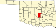 | |
| Towns | ||
| CDP | ||
| Other communities | ||
| Ghost towns | ||
| Footnotes | ‡This populated place also has portions in an adjacent county or counties | |
| International | |
|---|---|
| National | |
This Oklahoma state location article is a stub. You can help Wikipedia by expanding it. |
- Use mdy dates from July 2023
- Articles with short description
- Short description is different from Wikidata
- Coordinates on Wikidata
- Pages using infobox settlement with possible area code list
- Articles with VIAF identifiers
- Articles with J9U identifiers
- Articles with LCCN identifiers
- Unincorporated communities in Pottawatomie County, Oklahoma
- Unincorporated communities in Oklahoma
- Census-designated places in Oklahoma
- Populated places established in 1893
- 1893 establishments in Oklahoma Territory
- All stub articles
- Oklahoma geography stubs