Culburnie, Highland
Culburnie
| |
|---|---|
 Culburnie Location within the Inverness area | |
| Population | 121 |
| OS grid reference | NH486414 |
| Council area | |
| Country | Scotland |
| Sovereign state | United Kingdom |
| Post town | Kiltarlity |
| Postcode district | IV4 7 |
| Police | Scotland |
| Fire | Scottish |
| Ambulance | Scottish |
| UK Parliament |
|
| Scottish Parliament |
|
Culburnie (Scottish Gaelic: Cùil Braonaigh, Scots: Chainry) is a scattered hamlet in the Highland council area of Scotland. It is 1.2 miles (2 km) west of Kiltarlity, and 12.4 miles (20 km) west of Inverness.[1][2]
The name may come from the Gaelic term for "at the back of the damp place".[3]
Until 1968, Culburnie had its own primary school, built sometime in the 19th century by the Free Church of Scotland.[4] Primary pupils now travel to the nearby school at Tomnacross, while secondary students attend Charleston Academy in Inverness.
The Culburnie Burn (also known as the Teanacoil Burn) passes through the area before flowing into the Bruiach Burn, which in turn joins the Beauly River and Firth.
-
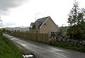 One of several houses in the Culburnie area

References
- ^ "Culburnie". The Gazetteer for Scotland. School of GeoSciences, University of Edinburgh and The Royal Scottish Geographical Society. Retrieved 17 June 2018.
- ^ Microsoft; Nokia. "Culburnie" (Map). Bing Maps. Microsoft. Retrieved 26 February 2017.
- ^ Beauly, The Aird and Strathglass Place-Name Survey (North-East Inverness-shire)
- ^ "Geograph:: Old Culburnie School © Craig Wallace cc-by-sa/2.0". www.geograph.org.uk. Retrieved 28 July 2020.
This Highland location article is a stub. You can help Wikipedia by expanding it. |
- Pages using gadget WikiMiniAtlas
- Use dmy dates from October 2019
- Articles with short description
- Short description is different from Wikidata
- Articles containing Scottish Gaelic-language text
- Articles containing Scots-language text
- Articles with OS grid coordinates
- Coordinates on Wikidata
- Populated places in Inverness committee area
- All stub articles
- Highland geography stubs