Cessange
Jump to navigation
Jump to search
Cessange
| |
|---|---|
 Cessange is one of 24 quarters in Luxembourg City | |
| Coordinates: 49°35′17″N 6°06′15″E / 49.58806°N 6.10417°E | |
| Country | Luxembourg |
| Commune | Luxembourg City |
| Area | |
| • Total | 6.5783 km2 (2.5399 sq mi) |
| Population (31 December 2022)[2] | |
| • Total | 4,927 |
| • Density | 750/km2 (1,900/sq mi) |
| Nationality | |
| • Luxembourgish | 33.60% |
| • Other | 66.40% |
| Website | Cessange |
Cessange (Luxembourgish: Zéisseng, pronounced [ˈtsəɪseŋ] ⓘ; German: Zessingen) is a quarter in south-western Luxembourg City, in southern Luxembourg.
Most of the quarter is covered by open fields to the south-west of Luxembourg City proper. At the centre of the quarter is the Croix de Cessange: a motorway junction between the A4 and the A6. Next to the intersection is Stade Boy Konen, which plays host to FC CeBra 01, Rugby Club Luxembourg, and the Luxembourg national rugby union team.[citation needed]
Population
As of 31 December 2022[update], Cessange has a population of 4,927 inhabitants. [2]
Gallery
-
 The primary school
 -
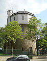 The water tower
 -
 The cultural center
 -
 The sports center
 -
 The catholic church
 -
 The local brook
 -
 The cemetery


.JPG)

References
- ^ "Cessange". www.vdl.lu (in French). Ville de Luxembourg. Retrieved 15 June 2018.
- ^ a b c "Statistiques sur la Ville de Luxembourg: Etat de Population - 2022" (PDF). www.vdl.lu (in French). Ville de Luxembourg. Retrieved 14 January 2024.
This article related to the geography of Luxembourg canton is a stub. You can help Wikipedia by expanding it. |
Categories:
- Pages using the Phonos extension
- CS1 French-language sources (fr)
- Use dmy dates from June 2018
- Articles with short description
- Short description is different from Wikidata
- Articles containing Luxembourgish-language text
- Articles containing German-language text
- Coordinates on Wikidata
- Pages with Luxembourgish IPA
- Pages including recorded pronunciations
- All articles with unsourced statements
- Articles with unsourced statements from June 2018
- Articles containing potentially dated statements from December 2022
- All articles containing potentially dated statements
- Quarters of Luxembourg City
- All stub articles
- Luxembourg canton geography stubs