Bolshoy Ik
Jump to navigation
Jump to search
| Bolshoy Ik | |
|---|---|
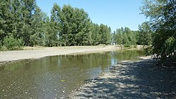
 Very small ford across the Bolshoy Ik | |
| Location | |
| Country | Bashkortostan and Orenburg Oblast, Russia |
| Physical characteristics | |
| Source | |
| • location | South Urals, Bashkortostan |
| Mouth | Sakmara |
• location | Saraktash, Orenburg Oblast |
• coordinates | 51°49′24″N 56°23′22″E / 51.82333°N 56.38944°E |
| Length | 341 km (212 mi) |
| Basin size | 7,670 km2 (2,960 sq mi) |
| Discharge | |
| • average | 61 m3/s (2,200 cu ft/s) |
| Basin features | |
| Progression | Sakmara→ Ural→ Caspian Sea |
The Bolshoy Ik (Russian: Большой Ик, literally Greater Ik; Bashkir: Оло Ыйыҡ, Olo Iyıq) is a tributary of the Sakmara, which flows south from the southern end of the Ural Mountains in Bashkortostan and Orenburg Oblast, Russia.
The river is generally fed by snowmelt.[1]
See also
References
Categories:
- Articles with short description
- Short description is different from Wikidata
- Coordinates on Wikidata
- Tributaries of the Ural River
- Articles containing Russian-language text
- Articles containing Bashkir-language text
- Rivers of Bashkortostan
- Rivers of Orenburg Oblast
- Ural basin
- All stub articles
- Bashkortostan geography stubs
- Volga Federal District geography stubs
- Russia river stubs