Bolkowice, Lower Silesian Voivodeship
Jump to navigation
Jump to search
Bolkowice | |
|---|---|
Village | |
 Houses | |
 Bolkowice Location of Bolkowice, Lower Silesian Voivodeship | |
| Coordinates: 50°59′35″N 16°11′50″E / 50.99306°N 16.19722°E | |
| Country | |
| Voivodeship | Lower Silesian |
| Powiat | Jawor |
| Gmina | Paszowice |

Bolkowice [bɔlkɔˈvit͡sɛ] is a village in the administrative district of Gmina Paszowice, within Jawor County, Lower Silesian Voivodeship, in south-western Poland.[1] Prior to 1945 it was in Germany.
It lies approximately 7 km (4 mi) south of Jawor, and 61 km (38 mi) west of the regional capital Wrocław.
Gallery
-
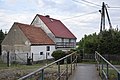 House
House -
 Road
Road -
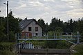 Dam
Dam
_(0003).jpg)
_(0004).jpg)
_(0005).jpg)
References
Wikimedia Commons has media related to Bolkowice.
This Jawor County location article is a stub. You can help Wikipedia by expanding it. |