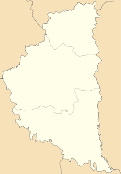
Bila, Chortkiv Raion, Ternopil Oblast
Jump to navigation
Jump to search
Bila
Біла | |
|---|---|
| Coordinates: 49°02′44″N 25°46′56″E / 49.04556°N 25.78222°E | |
| Country | |
| Oblast | |
| Raion | Chortkiv Raion |
| Hromada | Chortkiv Hromada |
| Time zone | UTC+2 (EET) |
| • Summer (DST) | UTC+3 (EEST) |
| Postal code | 48514 |
Bila (Ukrainian: Біла) is a village in Ukraine, Ternopil Oblast, Chortkiv Raion, Chortkiv urban hromada.[1]
History
The first written mention dates back to the XIV century, when a castle was built in the village.[2]
Religion
- Church of the Holy Apostle Andrew the First-Called (OCU),[3]
- Church of the Nativity of the Blessed Virgin Mary (1903, OCU, brick),[3]
- Church of the Exaltation of the Holy Cross (2008, UGCC)[3]
- Church of the Resurrection (1751, lost, UGCC)[3]
- Roman Catholic chapel (1899)[4]
People
- Petro Fedoryshyn (born 1949), Ukrainian journalist, editor, teacher, and sports figure[3]
In the literature
Petro Fedoryshyn has published two books about his family's village: U vodovertiakh Seretu (2012) and Vazhkyi kozhykh, ale svii (2015).[5]
References
- ^ Чортківська територіальна громада, Децентралізація
- ^ Володимир Добрянський. Нові археологічні відкриття городищ XIV та XVII ст. і фортифікаційних споруд на Західному Поділлі, Замковий туризм Тернопільської області: проблеми та перспективи розвитку. Матеріали Міжнародної науково-практичної конференції (4 травня 2012 року), Тернопіль : ТНПУ ім. В. Гнатюка, 2012, 47—52 s.
- ^ a b c d e (in Ukrainian) В. Уніят, Біла // Ternopil region. History of cities and villages: in 3 v. / Ternopil: "Terno-graph", 2014, V. 3: М—Ш, S. 450—453. — ISBN 978-966-457-246-7.
- ^ Біла. Колишня каплиця без титулу Archived 2021-10-05 at the Wayback Machine, Костели і каплиці України.
- ^ Тетяна Дігай, Енциклопедична трилогія про Чортків, Золота пектораль, 29.07.2022.
Categories:
- Pages using gadget WikiMiniAtlas
- Articles with Ukrainian-language sources (uk)
- Webarchive template wayback links
- Articles with short description
- Short description is different from Wikidata
- Coordinates on Wikidata
- Articles containing Ukrainian-language text
- Villages in Chortkiv Raion
- Chortkiv urban hromada
- All stub articles
- Ternopil Oblast geography stubs


