Bewl Water
| Bewl Water | |
|---|---|
 Bewl Water | |
| Location | Kent/East Sussex |
| Coordinates | 51°04′12″N 0°23′42″E / 51.06997°N 0.39508°E |
| Lake type | Reservoir |
| Basin countries | United Kingdom |
| Shore length1 | 20.4 km (12.7 mi) |
| Settlements | Wadhurst |
| Website | www |
| 1 Shore length is not a well-defined measure. | |
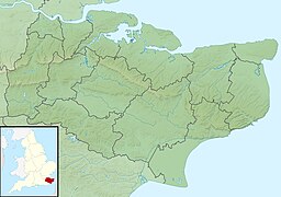
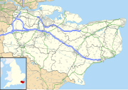
Bewl Water is a reservoir in the valley of the River Bewl, straddling the boundary between Kent and East Sussex in England. It is about 2 miles (3.2 km) south of Lamberhurst, Kent.[1] The reservoir was part of a project to increase the supply of water in the area. It supplies Southern Water's customers in the towns of Thanet and Hastings.[2]
Work to construct the reservoir began in 1973 with the damming and subsequent flooding of the Bewl River valley. It was completed in 1975, having been filled with over 31,300 million litres of water, with a total project cost of £11 million.[2] It is now the largest body of inland water in Southeast England.[3]
In winter, when the flow in the River Medway exceeds 275 million litres per day, river water is pumped to the reservoir for storage. There is an outlined plan to raise the water level by a further three metres with intentions of increasing the yield by up to 30% to help with the growing water demand in Southeast England. This will, however, put further demands on the River Medway to supply the additional water required, with the potential for environmental degradation in the river and the ecosystems that it supports.[citation needed]
Leisure use
Bewl Water Outdoor Centre hosts a variety of outdoor activities[4] on and around the reservoir. These include sailing, windsurfing, rowing, sculling, canoeing, kayaking, trout & predator fishing, and paddleboarding. A floating obstacle course is also available on the reservoir.[5]
Away from the water, numerous walking and cycling routes surround the 12½-mile Round Reservoir Route.[6]
References
- ^ "Water companies warn parts of UK could see drought this summer after the driest winter in more than 20 years". The Daily Telegraph. 18 April 2017. Retrieved 25 July 2022.
- ^ a b "A brief history of Bewl Water". The Times of Tunbridge Wells. 13 April 2016. Archived from the original on 1 December 2017.
- ^ "Bewl Water | History & Visiting Information". Britain Express. Retrieved 13 December 2022.
- ^ "All about Bewl Water Country Park". Great British Life. 21 July 2016. Retrieved 13 December 2022.
- ^ "Bewl Water Aqua Park - The UK'S Best Wibit Outdoor, Floating, Inflatable Sports Aqua Park". Bewl Water Aqua Park - The UK'S Best Wibit Outdoor, Floating, Inflatable Sports Aqua Park. Retrieved 13 December 2022.
- ^ "WALKING, RIDING & CYCLING". bewlwater.co.uk. Archived from the original on 1 September 2012.
External links
- Articles with short description
- Short description is different from Wikidata
- Use dmy dates from June 2015
- Use British English from June 2015
- Coordinates on Wikidata
- Articles using infobox body of water without image bathymetry
- Articles with OS grid coordinates
- All articles with unsourced statements
- Articles with unsourced statements from August 2023
- Tourist attractions in Kent
- Drinking water reservoirs in England
- Buildings and structures in the Borough of Tunbridge Wells
- Parks and open spaces in Kent
- Country parks in Kent
- Sport in Royal Tunbridge Wells
- Reservoirs in Kent
- Ticehurst

