Ballinroad
Jump to navigation
Jump to search
Ballinroad
Baile an Rodaigh | |
|---|---|
Village | |
| Coordinates: 52°06′18″N 7°34′21″W / 52.105°N 7.5725°W | |
| Country | Ireland |
| Province | Munster |
| County | County Waterford |
| Elevation | 10 m (30 ft) |
| Population (2022)[1] | |
| • Total | 1,389 |
| Time zone | UTC+0 (WET) |
| • Summer (DST) | UTC-1 (IST (WEST)) |
| Irish Grid Reference | X293948 |
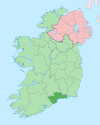
Ballinroad (Irish: Baile an Rodaigh, meaning "Rod's town")[2] is a village approximately 3 km from Dungarvan, County Waterford on the south coast of Ireland. Ballinroad grew rapidly during the Celtic tiger era and is now one of Dungarvan's main dormitory areas.[3]
Religion
Saint Lawrence's Catholic Church, c.1835, is located at Ballinroad Crossroads.[4]
Sport
Dungarvan golf club is based in Knocknagranagh, Ballinroad .[5]
Dungarvan Rugby Club is based in Ballyrandle, Ballinroad.
Ballinroad Football Club has been part of the community since 1971, with under-age and junior teams competing in the local Waterford league. The club's first team gained promotion to the Premier League for the first time ever in 2019.
See also
References
- ^ "Interactive Data Visualisations: Towns: Ballinroad". Census 2022. Central Statistics Office. Retrieved 26 September 2023.
- ^ "Baile an Rodaigh/Ballinroad". Placenames Database of Ireland (logainm.ie). Retrieved 1 January 2022.
- ^ "Ballinroad". Waterford County Local Authorities. Archived from the original on 14 May 2008. Retrieved 24 September 2009.
- ^ "Saint Lawrence's Catholic Church". Department of Arts, Heritage and the Gaeltacht. Archived from the original on 24 September 2021. Retrieved 26 January 2015.
- ^ "Dungarvangolfclub". Archived from the original on 9 July 2015. Retrieved 8 July 2015.
External links
Categories:
- Articles with short description
- Short description is different from Wikidata
- Use dmy dates from January 2021
- Use Hiberno-English from January 2021
- All Wikipedia articles written in Hiberno-English
- Short description matches Wikidata
- Articles containing Irish-language text
- Coordinates on Wikidata
- Articles with OS grid coordinates
- Towns and villages in County Waterford
- All stub articles
- Ireland geography stubs

