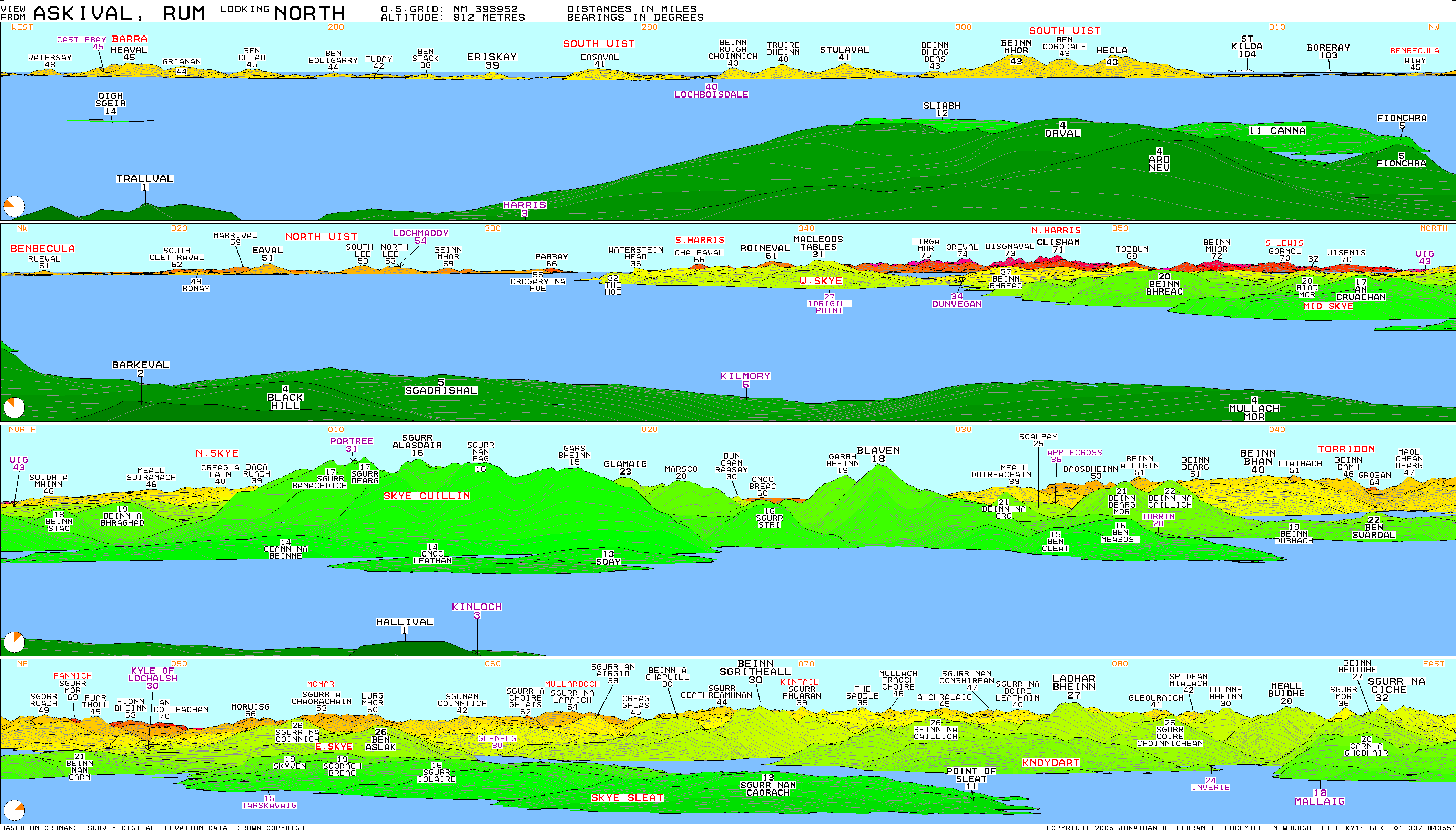
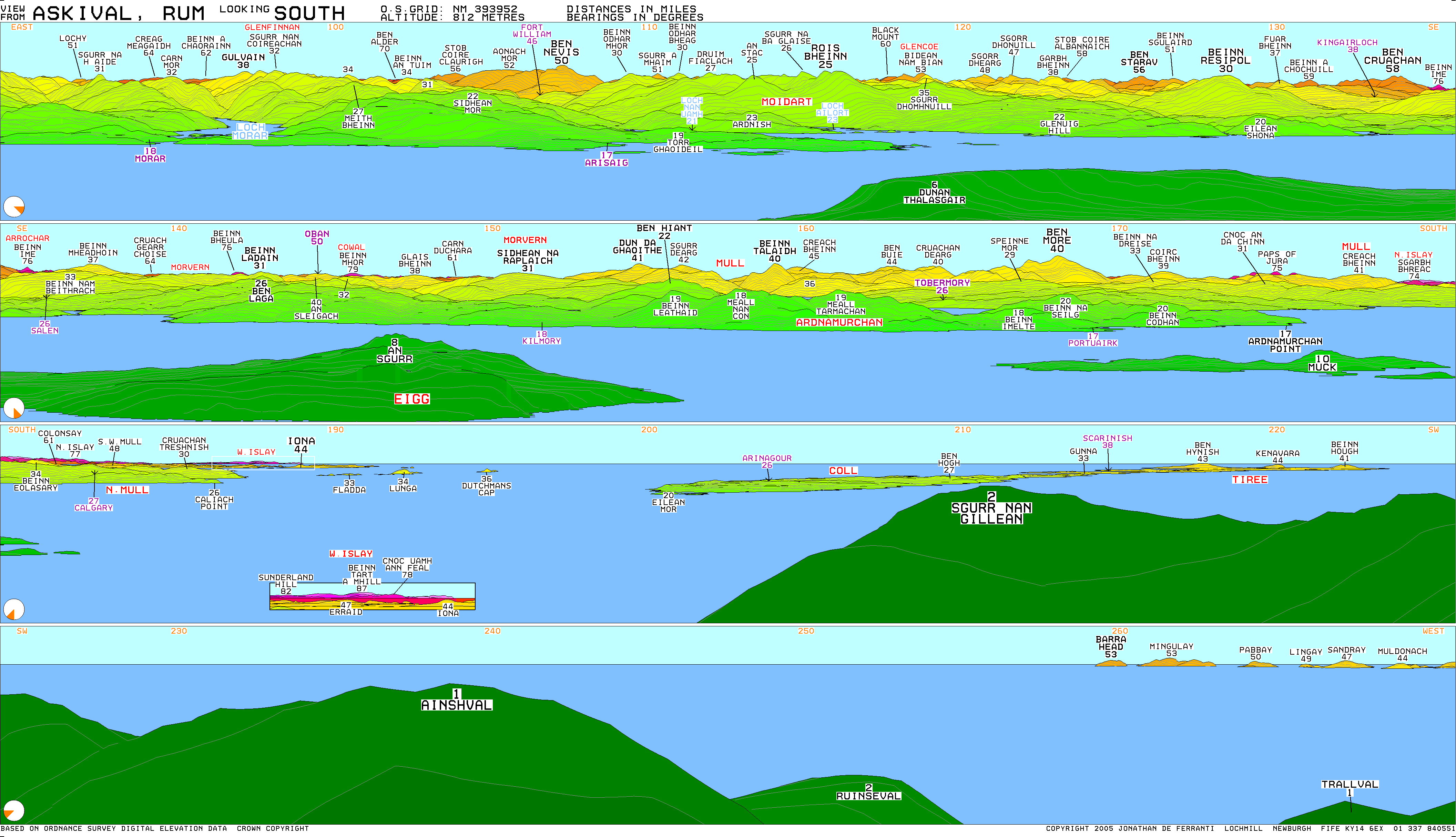
Askival
Jump to navigation
Jump to search
| Askival | |
|---|---|
 Askival from the path between Kinloch and Dibidil | |
| Highest point | |
| Elevation | 812 m (2,664 ft) |
| Prominence | 812 m (2,664 ft)Ranked 33rd in British Isles |
| Parent peak | none - HP Rùm |
| Listing | Marilyn, Corbett |
| Coordinates | 56°58′27″N 6°17′30″W / 56.97424°N 6.29168°W |
| Naming | |
| English translation | Ash tree mountain |
| Language of name | Norse |
| Pronunciation | /ˈæskɪvɑːl/ |
| Geography | |
| Parent range | The Cuillin of Rum |
| OS grid | NM393952 |
| Topo map | OS Landranger 39 |

Askival is the highest mountain on the island of Rùm, in the Inner Hebrides of Scotland. It is located 5 kilometres (3.1 mi) south of Kinloch, the main village on the island. It is part of the Rùm Cuillin, a rocky range of hills in the southern end of Rùm.[1] It is often climbed as part of a full traverse of the ridge.
References
- ^ Emeleus, C. H. (Charles Henry) (2008). A geological excursion guide to Rum : the Palaeocene igneous rocks of the Isle of Rum, Inner Hebrides. Troll, V. R. Edinburgh [Scotland]: Edinburgh Geological Society. ISBN 978-1-905267-22-4. OCLC 437092879.
External links
Wikimedia Commons has media related to Askival.
| Northern Highlands (20) |    | |
|---|---|---|
| Western Highlands (20) | ||
| Central and Eastern Highlands (13) | ||
| Southern Highlands (15) | ||
| Islands (13) | ||
| Scottish Lowlands, England and Wales (13) | ||
| Republic of Ireland, Northern Ireland (25) | ||
This Highland location article is a stub. You can help Wikipedia by expanding it. |
Categories:
- Use dmy dates from September 2019
- Articles with short description
- Short description is different from Wikidata
- Coordinates on Wikidata
- Articles with OS grid coordinates
- Pages using infobox mountain with language parameter
- Commons category link is on Wikidata
- Marilyns of Scotland
- Corbetts
- Mountains and hills of the Scottish islands
- Mountains and hills of Highland (council area)
- Rùm
- All stub articles
- Highland geography stubs