Arrondissement of Ostend
Jump to navigation
Jump to search
Arrondissement of Ostend
Arrondissement Oostende | |
|---|---|
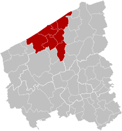
 Location of the arrondissement in West Flanders | |
| Coordinates: 51°12′N 2°54′E / 51.2°N 2.9°E | |
| Country | |
| Region | |
| Province | |
| Municipalities | 7 |
| Area | |
| • Total | 291.60 km2 (112.59 sq mi) |
| Population (1 January 2017) | |
| • Total | 155,717 |
| • Density | 530/km2 (1,400/sq mi) |
| Time zone | UTC+1 (CET) |
| • Summer (DST) | UTC+2 (CEST) |
The Arrondissement of Ostend (Dutch: Arrondissement Oostende; French: Arrondissement d'Ostende) is one of the eight administrative arrondissements in the Province of West Flanders, Belgium.
The Administrative Arrondissement of Ostend consists of the following municipalities:[1]
References
- ^ "Chiffres de population au 1er janvier 2022" (PDF). Federal Public Service Interior. Retrieved January 5, 2023.