Apple, Oklahoma
Jump to navigation
Jump to search
Apple, Oklahoma | |
|---|---|
 Apple Location within the state of Oklahoma  Apple Apple (the United States) | |
| Coordinates: 34°07′39″N 95°25′03″W / 34.12750°N 95.41750°W | |
| Country | United States |
| State | Oklahoma |
| County | Choctaw |
| Time zone | UTC-6 (Central (CST)) |
| • Summer (DST) | UTC-5 (CDT) |
| GNIS feature ID | 1100180 |
Apple is an unincorporated community located near Hugo Lake and State Highway 93 in Choctaw County, Oklahoma, United States.[1][2]
References
- ^ Official State Highway Map (Map) (2005-2006 ed.). Oklahoma Department of Transportation. § O7.
- ^ U.S. Geological Survey Geographic Names Information System: Apple, Oklahoma
Municipalities and communities of Choctaw County, Oklahoma, United States | ||
|---|---|---|
| City | 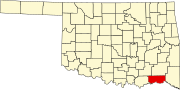 | |
| Towns | ||
| CDPs | ||
| Other unincorporated communities | ||
| Indian reservation | ||
| Footnotes | ‡This populated place also has portions in another county or counties | |
| International | |
|---|---|
| National | |
This Oklahoma state location article is a stub. You can help Wikipedia by expanding it. |
Categories:
- Pages using gadget WikiMiniAtlas
- Use mdy dates from July 2023
- Articles with short description
- Short description is different from Wikidata
- Coordinates on Wikidata
- Articles with VIAF identifiers
- Articles with LCCN identifiers
- Unincorporated communities in Choctaw County, Oklahoma
- Unincorporated communities in Oklahoma
- Choctaw Nation of Oklahoma
- All stub articles
- Oklahoma geography stubs