Anupgarh district
This article needs additional citations for verification. (March 2023) |
Anupgarh district | |
|---|---|
 View of canal in tehsil Rawla Mandi of Anupgarh district | |
.svg) Location of Anupgarh district in Rajasthan | |
| Coordinates (Anupgarh district headquarters): 29°11′22″N 73°12′30″E / 29.18944°N 73.20833°E | |
| Country | |
| State | Rajasthan |
| Division | Bikaner |
| Established | 7 August 2023 |
| Headquarters | Anupgarh |
| Tehsils | Raisinghnagar Anupgarh Ramsinghpur Sri Vijaynagar Gharsana Rawla Mandi |
| Government | |
| • Type | State Government |
| • Body | Government of Rajasthan |
| • District Magistrate | Avdhesh Meena, IAS[1] |
| • Superintendent of Police | Rajendra Kumar, IPS |
| Area | |
| • Total | 4,713.96 km2 (1,820.07 sq mi) |
| Population (2011)[2] | |
| • Total | 698,478 |
| • Density | 150/km2 (380/sq mi) |
| Demographics [2] | |
| • Literacy | 58.18 % |
| • Sex ratio | 899/1000 |
| Languages | |
| • Official | Hindi[3] |
| • Additional_official | English[3] |
| • Most spoken | Punjabi, Bagri, Rajasthani |
| Time zone | UTC+05:30 (IST) |
| Major highways | RJ SH 3 |
| Website | official website |
Anupgarh district is a new north-west district of Rajasthan state in India. It was established on 7 August 2023 after curving it out of Sri Ganganagar District.
History
Ancient history
Traces of Indus Valley Civilisation have been found at Baror and Binjor near Anupgarh city.
Mediaeval period

The ancient name of Anupgarh city was Chugher. Chugher (Anupgarh) and its surrounding area was occupied by Bhati rulers. The area was occupied by the removal of Bhati Chiefs by Maharaja of the Bikaner princely state under the leadership of chief Bikaji Anoop Singh in 1678 and constructed a fortress whose name was Anupgarh.[4]
Post-partition and modern history
After partition of India in 1947, Princely states were abolished and Anupgarh being a Dyodhiwale Rajvi, was made a separate tehsil under Sri Ganganagar District.
On 17 March 2023,[5] following 11 years of peaceful protest by the local citizens under the leadership of Advocate Suresh Kumar Bishnoi, Jalandhar singh Toor with the support of farmers and other respectful leaders, it was carved out of Sri Ganganagar as a separate district.
- After notification on 7 th August 2023 the district was established carved out with parts from Ganganagar district and Bikaner district.
- On 6 October 2023, the Government of Rajasthan issued a notification regarding reorganisation of the Anupgarh district, according to this notification Chhatargarh and Khajuwala tehsils were remerged with Bikaner district.[6]
Demographics
Population
According to 2011 census of India, the total population of what is now Anupgarh district was 698,478. 114919 (16.45%) lived in urban areas. Anupgarh district had a sex ratio of Scheduled Castes and Scheduled Tribes made up 307,944 (44.09%) and 3,760 (0.60%) of the population respectively.[7][8]
| Tehsil | Population | Total families | Population Density people/km2 |
|---|---|---|---|
| Raisinghnagar | 196,455 | 37,854 | 148/km2 |
| Anupgarh | 1,84,423 | 36,488 | 159/km2 |
| Gharsana (including Rawla Mandi) | 1,71,830 | 34,350 | 124/km2 |
| Sri Vijaynagar | 1,45,770 | 28,721 | 172/km2 |
| Total/Average of Anupgarh District | 6,98,478 | 1,37,413 | 150.75/km2 |
Languages
At the time of the 2011 census, 32.80% Punjabi, 29.04% Bagri, 28.00% Rajasthani, 4.99% Hindi and 2.55% Marwari as their first language.[13] Along the India-Pakistan border, the language merges with the Riasti dialect of Saraiki.
Religion
| Tehsil | Hindu | Sikh | Muslim | Jain | Buddhist | Christians | Not stated | Others |
|---|---|---|---|---|---|---|---|---|
| Raisinghnagar [9] | 1,35,965 | 58,857 | 1,118 | 158 | 110 | 161 | 48 | 38 |
| Anupgarh [10] | 1,25,624 | 56,119 | 2,394 | 6 | 34 | 145 | 94 | 7 |
| Gharsana (including Rawla Mandi)[11] | 1,22,440 | 40,412 | 8,620 | 130 | 51 | 96 | 52 | 29 |
| Sri Vijaynagar [12] | 1,11,089 | 32,468 | 1,700 | 20 | 156 | 268 | 67 | 2 |
| Total of Anupgarh District | 4,95,118 | 1,87,856 | 13,832 | 314 | 463 | 558 | 261 | 76 |
Census 2011 shows that there were 4,95,118 Hindus and 1,87,856 Sikhs in the district with Muslims being third largest community in the district with around 13,832 individuals.[14]
Literacy rate
Average literacy rate and Sex ratio in Anupgarh district is 64.25 % and 898.5/1000 respectively.
According to census 2011, with 69.91% literacy, and a ratio of 908 females to 1000 males. Raisinghnagar is the most literate tehsil in Anupgarh district with hights sex ratio with 69.33% of male literates and 52.23% of female literates living in the tehsil. On the other hand, Gharsana shows the lowest literacy rate of 65.76% with 65.54% of males and 47.28% of females literate in the tehsil. Gharsana tehsil had a sex ratio of 892 females/1000 males in year 2011 which was least among all tehsils of Anupgarh District and Raisinghnagar had hightest sex ratio of 902 females/1000 males.
| Tehsil | Total literacy rate | Male literacy | Female literacy | Sex Ratio females/1000 males |
|---|---|---|---|---|
| Raisinghnagar[9] | 69.91% | 69.33% | 52.23% | 908 |
| Anupgarh [10] | 66.34% | 65.39% | 48.57% | 900 |
| Gharsana (including Rawla Mandi)[11] | 65.76% | 65.54% | 47.28% | 892 |
| Sri Vijaynagar [12] | 66.68% | 64.55% | 48.98 | 894 |
| Literacy rate and Sex ratio in district | 64.25 % | 63.45 % | 45.72 % | 899 |
Government and politics
Assembly constituencies
5. Raisinghnagar Assembly constituency
6. Anupgarh Assembly constituency
Administrative setup of Anupgarh District

Tehsil in Anupgarh District
There are 5 tehsils in the Anupgarh district.
Sub tehsils in Anupgarh District
In Anupgarh District There are also 5 Sub tehsils-
Panchayat Samitis in Anupgarh District
There are six Panchayat Samitis or Block panchayats and 177 Gram Panchayats in Anupgarh district.
- Anupgarh - 32 Gram Panchayats
- Raisinghnagar - 41 Gram Panchayats
- Vijaynagar - 29 Gram Panchayats
- Gharsana - 36 Gram Panchayats.
Tourist attractions
,Anupgarh_Sivender.jpg)
- Shivpur Fort - Vijaynagar
- Anupgarh Fort - Anupgarh
- Baror Harrapan Archaeological site -Anupgarh
- Gurudwara Budhdha Johar - Dabla
- Bishnoi Mandir & Amrita Devi Park - Dabla
- Laila Majhnu Mazar - Binjor
- Central Farm Jaitsar
- Rojhari Bala ji temple
Gallary
-
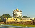 Baba deva singh radha swami dera
 -
 View of canal during sunset in Rawla
 -
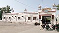 Anupgarh Railway Station
 -
 Shivpuri fort, Sri Vijaynagar


References
- ^ "Anupgarh - District Administration". Government of Rajathan. Retrieved 25 February 2024.
- ^ a b https://www.censusindia2011.com/rajasthan/ganganagar-population.html
- ^ a b "Report of the Commissioner for linguistic minorities: 52nd report (July 2014 to June 2015)" (PDF). Commissioner for Linguistic Minorities, Ministry of Minority Affairs, Government of India. pp. 34–35. Archived from the original (PDF) on 28 December 2017. Retrieved 16 February 2016.
- ^ Singh, Rajvi Amar (1992). Mediaeval History of Rajasthan: Western Rajasthan. Bikaner, Rajasthan, India: Singh. p. 347. OCLC 29798320.
- ^ a b "Rajasthan CM Ashok Gehlot announces formation of 19 new districts, 3 Divisional headquarters in Rajasthan". AIR News. 17 March 2023. Retrieved 11 June 2023.
- ^ name="languages2">"खाजूवाला और छतरगढ़ तहसील को अनूपगढ़ से हटाया". Dainik Bhaskar. 6 October 2023. Retrieved 6 October 2023.
- ^ "District Census Handbook: Sri Ganganagar" (PDF). censusindia.gov.in. Registrar General and Census Commissioner of India. 2011.
- ^ "District Census Handbook 2011 - Bikaner" (PDF). Census of India. Registrar General and Census Commissioner of India.
- ^ a b c https://www.censusindia2011.com/rajasthan/ganganagar/raisinghnagar-population.html
- ^ a b c https://www.censusindia2011.com/rajasthan/ganganagar/anupgarh-population.html
- ^ a b c https://www.censusindia2011.com/rajasthan/ganganagar/gharsana-population.html
- ^ a b c https://www.censusindia2011.com/rajasthan/ganganagar/vijainagar-population.html
- ^ "Table C-16 Population by Mother Tongue: Rajasthan". www.censusindia.gov.in. Registrar General and Census Commissioner of India.
- ^ "Table C-01 Population by religious community: Rajasthan". censusindia.gov.in. Registrar General and Census Commissioner of India.
This article needs additional or more specific categories. (March 2023) |
- Articles with short description
- Short description matches Wikidata
- Articles needing additional references from March 2023
- All articles needing additional references
- Use Indian English from February 2024
- All Wikipedia articles written in Indian English
- Use dmy dates from February 2024
- Short description is different from Wikidata
- Pages using infobox settlement with bad settlement type
- Coordinates on Wikidata
- Articles needing additional categories from March 2023
- Districts of Rajasthan
- Anupgarh district