Amt Wachsenburg
Jump to navigation
Jump to search
Amt Wachsenburg | |
|---|---|
 Coat of arms | |
Location of Amt Wachsenburg within Ilm-Kreis district 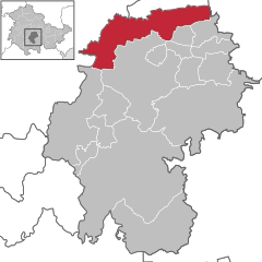 | |
 Amt Wachsenburg  Amt Wachsenburg | |
| Coordinates: 50°52′N 10°55′E / 50.867°N 10.917°E | |
| Country | Germany |
| State | Thuringia |
| District | Ilm-Kreis |
| Subdivisions | 13 |
| Government | |
| • Mayor (2022–28) | Sebastian Schiffer[1] |
| Area | |
| • Total | 77.75 km2 (30.02 sq mi) |
| Elevation | 260 m (850 ft) |
| Population (2022-12-31)[2] | |
| • Total | 8,001 |
| • Density | 100/km2 (270/sq mi) |
| Time zone | UTC+01:00 (CET) |
| • Summer (DST) | UTC+02:00 (CEST) |
| Vehicle registration | IK |
Amt Wachsenburg is a municipality in the district Ilm-Kreis, in Thuringia, Germany. The municipality is named after the Wachsenburg Castle which is located in its center. It was formed on 31 December 2012 from the former municipalities Wachsenburggemeinde and Ichtershausen. The former municipality Kirchheim was merged into Amt Wachsenburg in January 2019, and Rockhausen in December 2019. It consists of the villages Bechstedt-Wagd, Bittstädt, Eischleben, Haarhausen, Holzhausen, Ichtershausen, Kirchheim, Rehestädt, Rockhausen, Röhrensee, Sülzenbrücken, Thörey and Werningsleben.
References
- ^ Gewählte Bürgermeister - aktuelle Landesübersicht, Freistaat Thüringen, accessed 10 November 2022.
- ^ "Bevölkerung der Gemeinden, erfüllenden Gemeinden und Verwaltungsgemeinschaften in Thüringen Gebietsstand: 31.12.2022" (in German). Thüringer Landesamt für Statistik. June 2023.
Towns and municipalities in Ilm-Kreis | ||
|---|---|---|
 | ||
| International | |
|---|---|
| National | |
| Geographic | |
This Ilm-Kreis location article is a stub. You can help Wikipedia by expanding it. |
Categories:
- Pages using gadget WikiMiniAtlas
- CS1 German-language sources (de)
- Articles with short description
- Short description matches Wikidata
- Coordinates on Wikidata
- Municipalities in Thuringia
- Articles with VIAF identifiers
- Articles with GND identifiers
- Articles with MusicBrainz area identifiers
- Ilm-Kreis
- Saxe-Coburg and Gotha
- All stub articles
- Thuringia geography stubs