Šared
Jump to navigation
Jump to search
Šared | |
|---|---|
View of Izola from Šared | |
| Coordinates: 45°30′51.69″N 13°39′8.44″E / 45.5143583°N 13.6523444°E | |
| Country | |
| Traditional region | Littoral |
| Statistical region | Coastal–Karst |
| Municipality | Izola |
| Area | |
| • Total | 4.75 km2 (1.83 sq mi) |
| Elevation | 209.8 m (688.3 ft) |
| Population (2002) | |
| • Total | 508 |
| [1] | |
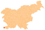
Šared (pronounced [ʃaˈɾeːt]; Italian: Saredo, formerly San Giacomo[2]) is a village in the Municipality of Izola in the Littoral region of Slovenia.[3]
Church
The local church, built outside the settlement, is dedicated to Saint James.[4] The church was damaged after the Second World War and abandoned.[5] It was renovated in 2003.[6]
References
- ^ Statistical Office of the Republic of Slovenia
- ^ Spezialortsrepertorium der österreichischen Länder. Bearbeitet auf Grund der Ergebnisse der Volkszählung vom 31. Dezember 1910, vol. 7: Österreichisch-Illyrisches Küstenland. Vienna: K. k. Hof- und Staatsdruckerei. 1918. p. 38.
- ^ Izola municipal site
- ^ Slovenian Istria site
- ^ Morato, Nada (1995). Ravnikova dediščina v Kortah. Koper: Zgodovinsko društvo za južno Primorsko. pp. 76, 156.
- ^ "Šared - Cerkev sv. Jakoba". Register kulturne dediščine. Ministrstvo za kulturo. Retrieved March 11, 2023.
External links

