Milburn, Utah
(Redirected from Milburn, UT)
Milburn | |
|---|---|
 Milburn Location within the state of Utah | |
| Coordinates: 39°42′15″N 111°25′30″W / 39.70417°N 111.42500°W | |
| Country | United States |
| State | Utah |
| County | Sanpete |
| Named for | Sawmills |
| Elevation | 6,365 ft (1,940 m) |
| Time zone | UTC-7 (Mountain (MST)) |
| • Summer (DST) | UTC-6 (MDT) |
| ZIP code | 84629 |
| Area code | 435 |
| GNIS feature ID | 1443385[1] |
Milburn is an unincorporated community in Sanpete County, Utah, United States.
Description
| Census | Pop. | Note | %± |
|---|---|---|---|
| 1900 | 213 | — | |
| 1910 | 103 | −51.6% | |
| 1920 | 146 | 41.7% | |
| 1930 | 137 | −6.2% | |
| 1940 | 101 | −26.3% | |
| 1950 | 57 | −43.6% | |
| Source: U.S. Census Bureau[2] | |||
The settlement is mainly an outgrowth of Fairview on the San Pitch River. Milburn has had several names in the past such as Milborn and Millburn, all of which were related in some way to the early sawmills built at the mouth of nearby canyons. Today, Milburn is mostly an agricultural region.
See also
References
- ^ a b U.S. Geological Survey Geographic Names Information System: Milburn, Utah. Retrieved May 19, 2011.
- ^ "Census of Population and Housing". U.S. Census Bureau. Retrieved November 7, 2011.
External links
![]() Media related to Milburn, Utah at Wikimedia Commons
Media related to Milburn, Utah at Wikimedia Commons
Municipalities and communities of Sanpete County, Utah, United States | ||
|---|---|---|
| Cities | 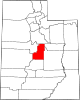 | |
| Towns | ||
| Unincorporated communities | ||
| Ghost towns | ||
| International | |
|---|---|
| National | |
This article about a location in Utah is a stub. You can help Wikipedia by expanding it. |
Categories:
- Pages using gadget WikiMiniAtlas
- Articles with short description
- Short description is different from Wikidata
- Use mdy dates from July 2023
- Coordinates on Wikidata
- Commons category link is on Wikidata
- Articles with VIAF identifiers
- Articles with J9U identifiers
- Articles with LCCN identifiers
- Unincorporated communities in Sanpete County, Utah
- Unincorporated communities in Utah
- All stub articles
- Utah geography stubs