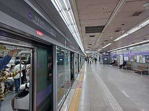
Gangdong station
 Station platform | |||||||||||||||
| Korean name | |||||||||||||||
| Hangul | 강동역 | ||||||||||||||
| Hanja | |||||||||||||||
| Revised Romanization | Gangdong-yeok | ||||||||||||||
| McCune–Reischauer | Kangdong-yŏk | ||||||||||||||
| General information | |||||||||||||||
| Location | 1099 Cheonhodaero, 447 Cheonho 3-dong, Gangdong-gu, Seoul[1] | ||||||||||||||
| Operated by | Seoul Metro | ||||||||||||||
| Line(s) | Line 5 | ||||||||||||||
| Platforms | 2 | ||||||||||||||
| Tracks | 3 | ||||||||||||||
| Construction | |||||||||||||||
| Structure type | Underground | ||||||||||||||
| History | |||||||||||||||
| Opened | November 15, 1995[1] | ||||||||||||||
| Services | |||||||||||||||
| |||||||||||||||
Gangdong Station (강동역, 江東驛, river east station) is a station on Seoul Subway Line 5. The line branches off to the northeast and the southeast at this point, with Gil-dong station to the northeast and Dunchon-dong station to the southeast. Cheonho station precedes it on the west.[1][2][3]
history
November 15, 1995: Business began with the opening of the section between Wangsimni Station and Sangil-dong Station on Seoul Subway Line 5. March 30, 1996: It became a transfer station with the opening of the Gangdong Station to Macheon Station section of Line 5’s Macheonji Line. August 1, 2016: Bugi station name changed to Gangdong Sacred Heart Hospital. August 2019: Bugi station name deleted due to expiration of contract period.
Station layout
| G | Street level | Exit |
| L1 Concourse |
Lobby | Customer Service, Shops, Vending machines, ATMs |
| L2 Platforms |
Side platform, doors will open on the right | |
| Westbound | ← Line 5 toward Banghwa (Cheonho) | |
| Island platform, doors will open on the left | ||
| Eastbound | Line 5 toward Hanam Geomdansan (Gil-dong)→ Line 5 toward Macheon (Dunchon-dong)→ | |
Around the station
- Dongshin Middle School
- Hallym University Gangdong Sacred Heart Hospital
- Gangdong Tax Office
- KT 강동지사
- 강동역sk리더스뷰 Scheduled for August 2026
References
37°32′09″N 127°07′56″E / 37.53583°N 127.13222°E
- CS1 Korean-language sources (ko)
- Pages using gadget WikiMiniAtlas
- Use mdy dates from June 2020
- Articles containing Korean-language text
- Articles using Infobox station with markup inside name
- Articles using Infobox station with links or images inside name
- Coordinates on Wikidata
- Railway stations opened in 1995
- Seoul Metropolitan Subway stations
- Metro stations in Gangdong District
- Railway stations in South Korea opened in the 1990s
- All stub articles
- Seoul metro station stubs
