File:קיסריה העתיקה.jpg
Original file (5,464 × 3,070 pixels, file size: 15.5 MB, MIME type: image/jpeg)
This file is from a shared repository and may be used by other projects. The description on its file description page there is shown below.
Summary
Descriptionקיסריה העתיקה.jpg |
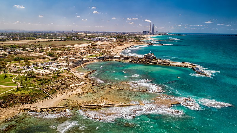
עברית: חוף דור הבונים: היא רצועת חוף באורך של 4.5 ק"מ המשתרעת ממושב הבונים בצפון ועד לאזור מושב דור ומכאן שמה. רצועת החוף כוללת את חוף הבונים ואת חוף דור המוכר לציבור גם בשמו הישן, חוף טנטורה.
|
||
Date | |||
Source | Own work | ||
Author | Idomeir |
Camera location | 32° 36′ 34.2″ N, 34° 54′ 51.3″ E | View this and other nearby images on: OpenStreetMap | 32.609500; 34.914250 |
---|
Licensing
- You are free:
- to share – to copy, distribute and transmit the work
- to remix – to adapt the work
- Under the following conditions:
- attribution – You must give appropriate credit, provide a link to the license, and indicate if changes were made. You may do so in any reasonable manner, but not in any way that suggests the licensor endorses you or your use.
- share alike – If you remix, transform, or build upon the material, you must distribute your contributions under the same or compatible license as the original.
This image was uploaded as part of Wiki Loves Monuments 2021.
Afrikaans ∙ Alemannisch ∙ azərbaycanca ∙ Bahasa Indonesia ∙ Bahasa Melayu ∙ Bikol Central ∙ bosanski ∙ brezhoneg ∙ català ∙ čeština ∙ Cymraeg ∙ dansk ∙ davvisámegiella ∙ Deutsch ∙ eesti ∙ English ∙ español ∙ Esperanto ∙ euskara ∙ français ∙ Frysk ∙ Gaeilge ∙ galego ∙ hrvatski ∙ Ido ∙ italiano ∙ latviešu ∙ Lëtzebuergesch ∙ Malagasy ∙ magyar ∙ Malti ∙ Nederlands ∙ norsk ∙ norsk nynorsk ∙ norsk bokmål ∙ polski ∙ português ∙ português do Brasil ∙ română ∙ shqip ∙ sicilianu ∙ slovenčina ∙ slovenščina ∙ suomi ∙ svenska ∙ Tagalog ∙ Türkçe ∙ Yorùbá ∙ Zazaki ∙ Ελληνικά ∙ беларуская ∙ беларуская (тарашкевіца) ∙ български ∙ кыргызча ∙ македонски ∙ русский ∙ српски / srpski ∙ українська ∙ ქართული ∙ հայերեն ∙ नेपाली ∙ हिन्दी ∙ বাংলা ∙ മലയാളം ∙ ไทย ∙ 한국어 ∙ +/− |
Items portrayed in this file
depicts
some value
32°36'34.2"N, 34°54'51.5"E
2.5 second
11
8.80000019073486328125 millimetre
100
File history
Click on a date/time to view the file as it appeared at that time.
Date/Time | Thumbnail | Dimensions | User | Comment | |
---|---|---|---|---|---|
current | 13:40, 29 September 2021 | 5,464 × 3,070 (15.5 MB) | commons>Idomeir | Uploaded own work with UploadWizard |
File usage
There are no pages that use this file.
Metadata
This file contains additional information, probably added from the digital camera or scanner used to create or digitize it.
If the file has been modified from its original state, some details may not fully reflect the modified file.
Camera manufacturer | DJI |
---|---|
Camera model | FC6310S |
Exposure time | 5/2 sec (2.5) |
F Number | f/11 |
ISO speed rating | 100 |
Date and time of data generation | 11:55, 6 June 2021 |
Lens focal length | 8.8000001907349 mm |
Altitude | 35.767 meters above sea level |
Horizontal resolution | 300 dpi |
Vertical resolution | 300 dpi |
Software used | Adobe Photoshop Lightroom Classic 10.2 (Macintosh) |
File change date and time | 14:14, 6 June 2021 |
Exposure Program | Manual |
Exif version | 2.31 |
Date and time of digitizing | 11:55, 6 June 2021 |
APEX shutter speed | −1.321928 |
APEX aperture | 6.918863 |
APEX exposure bias | 0.65625 |
Maximum land aperture | 2.9700000286102 APEX (f/2.8) |
Subject distance | 0 meters |
Metering mode | Center weighted average |
Light source | Daylight |
Flash | Flash did not fire, No flash function |
Color space | sRGB |
File source | Digital still camera |
Scene type | A directly photographed image |
Exposure mode | Manual exposure |
White balance | Auto white balance |
Digital zoom ratio | 0 |
Focal length in 35 mm film | 24 mm |
Scene capture type | Standard |
Scene control | None |
Contrast | Normal |
Saturation | Normal |
Sharpness | Normal |
Subject distance range | Unknown |
GPS tag version | 0.0.3.2 |
Lens used | 24.0 mm |
Serial number of camera | 764e90c860686df80fddb7d169368aee |
Date metadata was last modified | 17:14, 6 June 2021 |
Unique ID of original document | A26DA821708B1FEB2ABCCF0317F80C31 |
IIM version | 4 |