File:Zungeni map.png
Jump to navigation
Jump to search

Size of this preview: 800 × 543 pixels. Other resolutions: 320 × 217 pixels | 640 × 434 pixels | 1,024 × 695 pixels | 1,166 × 791 pixels.
Original file (1,166 × 791 pixels, file size: 1.94 MB, MIME type: image/png)
File history
Click on a date/time to view the file as it appeared at that time.
| Date/Time | Thumbnail | Dimensions | User | Comment | |
|---|---|---|---|---|---|
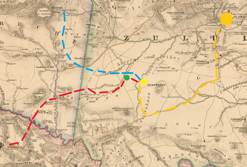
| current | 17:35, 6 January 2022 | | 1,166 × 791 (1.94 MB) | commons>Dumelow | == {{int:filedesc}} == {{Information |Description={{en|1=Military Map of Zulu Land, 1879}} |date=1879-05-21 Movements of the British 2nd Division (red) and Wood's flying column (blue) to Zungeni Mountain (yellow). Fort Newdigate shown in green and onwards movement to Ulundi in orange |Source={{Derived from|Military Map of Zulu Land.jpg|display=50}} |Date=2022-01-06 17:34 (UTC) |Author=* File:Military Map of Zulu Land.jpg: Intelligence Branch of the Qu... |
File usage
There are no pages that use this file.