File:Zavala County LasColonias.svg
Jump to navigation
Jump to search

Size of this PNG preview of this SVG file: 776 × 600 pixels. Other resolutions: 311 × 240 pixels | 621 × 480 pixels | 994 × 768 pixels | 1,280 × 989 pixels | 2,560 × 1,978 pixels | 990 × 765 pixels.
Original file (SVG file, nominally 990 × 765 pixels, file size: 197 KB)
File history
Click on a date/time to view the file as it appeared at that time.
| Date/Time | Thumbnail | Dimensions | User | Comment | |
|---|---|---|---|---|---|
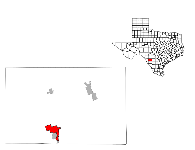
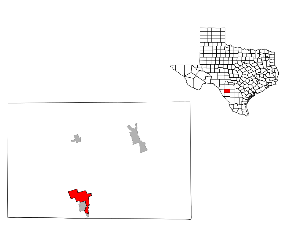
| current | 17:45, 3 December 2008 | | 990 × 765 (197 KB) | commons>25or6to4 | {{Information |Description={{en|1=Map of Zavala County, Texas highlighting Las Colonias}} |Source=Own work by uploader |Author=25or6to4 |Date=12/3/08 |Permission= |other_versions= }} <!--{{ImageUpload|full}}--> [[Category:Maps of Zavala |
File usage
There are no pages that use this file.