File:Yavapai County incorporated areas Black Canyon City highlighted.svg
Jump to navigation
Jump to search

Size of this PNG preview of this SVG file: 685 × 599 pixels. Other resolutions: 274 × 240 pixels | 549 × 480 pixels | 878 × 768 pixels | 1,170 × 1,024 pixels | 2,341 × 2,048 pixels.
Original file (SVG file, nominally 800 × 700 pixels, file size: 40 KB)
File history
Click on a date/time to view the file as it appeared at that time.
| Date/Time | Thumbnail | Dimensions | User | Comment | |
|---|---|---|---|---|---|
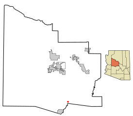
| current | 22:31, 20 March 2007 | | 800 × 700 (40 KB) | commons>Shereth | {{Information |Description=This map shows the incorporated areas in Yavapai County, Arizona, highlighting Black Canyon City in red. I created it in Inks |
File usage
There are no pages that use this file.