File:Wutip 2019-02-25 0345Z.jpg
Jump to navigation
Jump to search
Size of this preview: 450 × 600 pixels. Other resolutions: 180 × 240 pixels | 360 × 480 pixels | 576 × 768 pixels | 768 × 1,024 pixels | 1,536 × 2,048 pixels | 4,200 × 5,600 pixels.
Original file (4,200 × 5,600 pixels, file size: 6.1 MB, MIME type: image/jpeg)
Summary
| Description |
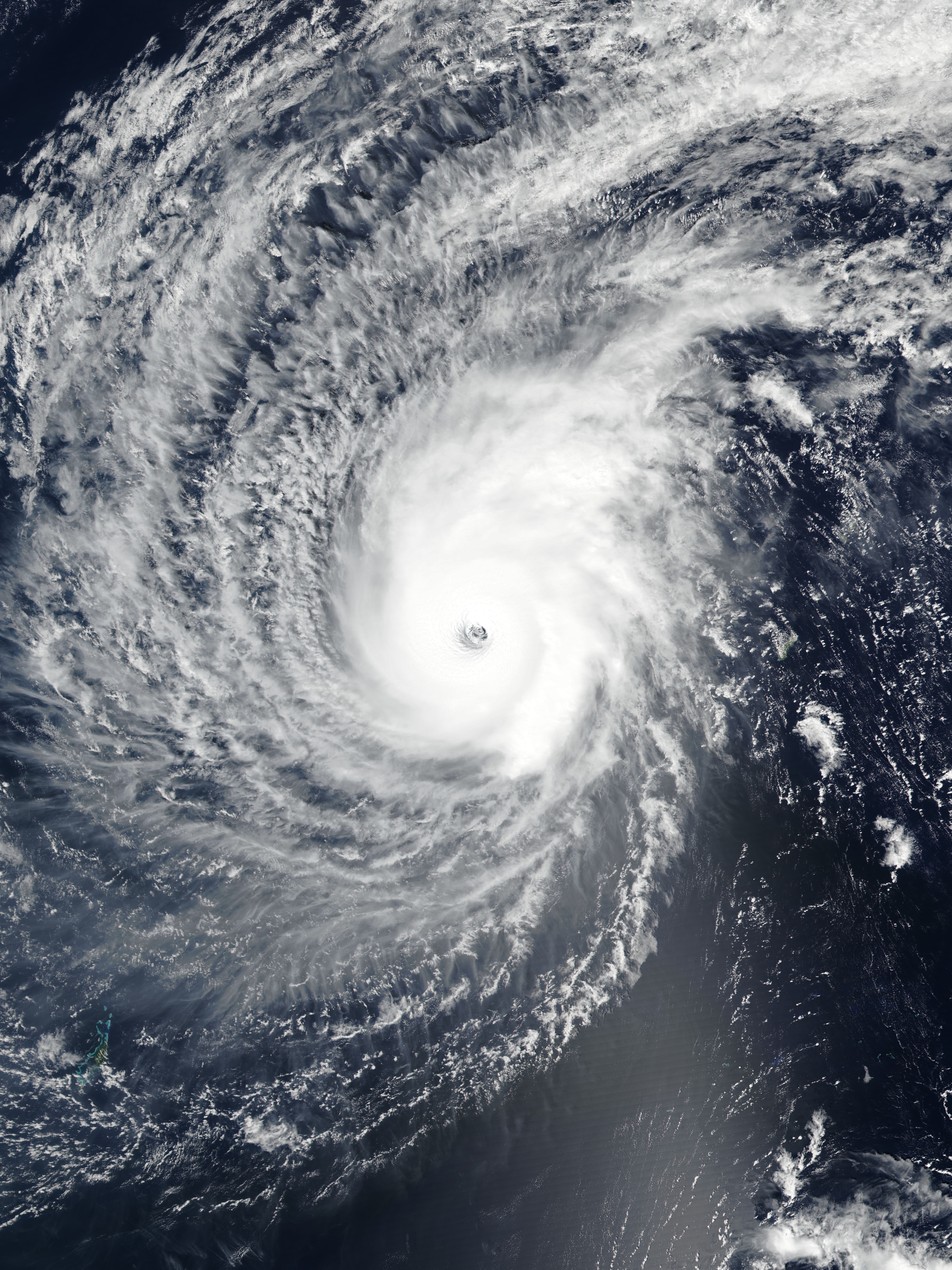
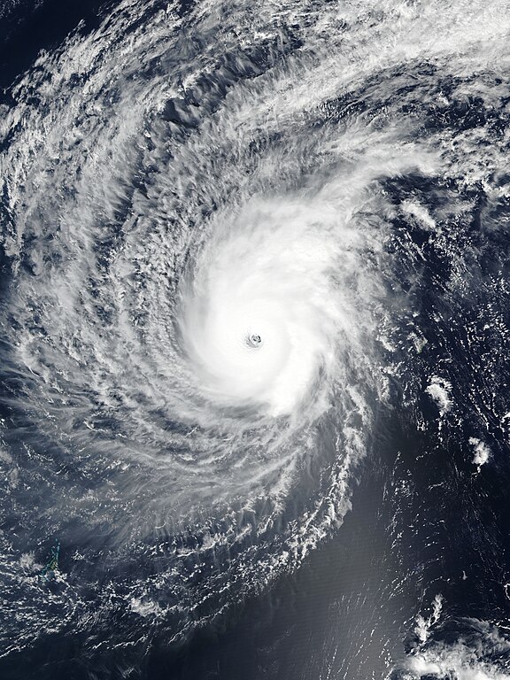
English: Typhoon Wutip near its secondary peak intensity west of Guam on February 25, 2019. |
| Date | |
| Source | EOSDIS Worldview |
| Author | VIIRS image captured by NOAA’s Suomi NPP satellite |
| Camera location | | View this and other nearby images on: OpenStreetMap |
|---|
Licensing
| This file is in the public domain in the United States because it was solely created by NASA. NASA copyright policy states that "NASA material is not protected by copyright unless noted". (See Template:PD-USGov, NASA copyright policy page or JPL Image Use Policy.) | ||
 |
Warnings:
|
File history
Click on a date/time to view the file as it appeared at that time.
| Date/Time | Thumbnail | Dimensions | User | Comment | |
|---|---|---|---|---|---|
| current | 13:58, 25 February 2019 | | 4,200 × 5,600 (6.1 MB) | commons>Meow | Rebuilt and optimised the picture with the accurate resolution (375m), the proper ratio (also narrowed to 97.6%), and the correct location of the center. |
File usage
There are no pages that use this file.