File:Wpdms nasa topo gila river.jpg
Jump to navigation
Jump to search
No higher resolution available.
Wpdms_nasa_topo_gila_river.jpg (300 × 300 pixels, file size: 60 KB, MIME type: image/jpeg)
File history
Click on a date/time to view the file as it appeared at that time.
| Date/Time | Thumbnail | Dimensions | User | Comment | |
|---|---|---|---|---|---|
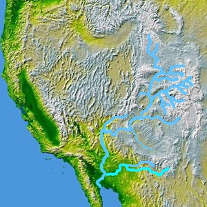
| current | 20:51, 16 April 2006 | | 300 × 300 (60 KB) | commons>Habj | Map showing Colorado River (top), its tributary Gila River, and Gila Rivers tributary Salt River (right). Brought here from enwiki en:Image:Wpdms nasa topo gila river.jpg, GFDL, uploaded there by Decumanus [[Category:Gila Rive |
File usage
There are no pages that use this file.