File:Workington Central, ex-C&W Junction derelict Locomotive Shed, 1951.jpg
Jump to navigation
Jump to search

Size of this preview: 800 × 430 pixels. Other resolutions: 320 × 172 pixels | 640 × 344 pixels | 1,024 × 550 pixels | 1,280 × 688 pixels | 2,312 × 1,242 pixels.
Original file (2,312 × 1,242 pixels, file size: 1.25 MB, MIME type: image/jpeg)
Summary
| Description |
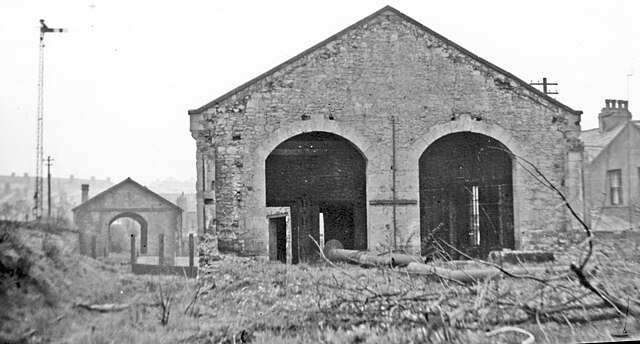
English: Workington Central, ex-C&W Junction derelict Locomotive Shed, 1951 View southward, just south of the former Workington Central station: see NY0028 : Northward at former Workington Central station, May 1951. |
| Date | |
| Source | geograph.org.uk |
| Author | Walter Dendy, deceased |
| Attribution (required by the license) | Walter Dendy, deceased / Workington Central, ex-C&W Junction derelict Locomotive Shed, 1951 / |
| Camera location | | View this and other nearby images on: OpenStreetMap |
|---|
_heading:180.00&language=en)
| Object location | | View this and other nearby images on: OpenStreetMap |
|---|
_heading:180.00&language=en)
Licensing

|
This image was taken from the Geograph project collection. See this photograph's page on the Geograph website for the photographer's contact details. The copyright on this image is owned by Walter Dendy, deceased and is licensed for reuse under the Creative Commons Attribution-ShareAlike 2.0 license.
|
This file is licensed under the Creative Commons Attribution-Share Alike 2.0 Generic license.
Attribution: Walter Dendy, deceased
- You are free:
- to share – to copy, distribute and transmit the work
- to remix – to adapt the work
- Under the following conditions:
- attribution – You must give appropriate credit, provide a link to the license, and indicate if changes were made. You may do so in any reasonable manner, but not in any way that suggests the licensor endorses you or your use.
- share alike – If you remix, transform, or build upon the material, you must distribute your contributions under the same or compatible license as the original.
File history
Click on a date/time to view the file as it appeared at that time.
| Date/Time | Thumbnail | Dimensions | User | Comment | |
|---|---|---|---|---|---|
| current | 16:19, 5 July 2017 | | 2,312 × 1,242 (1.25 MB) | commons>Bjh21 | Higher-resolution version from Geograph |
File usage
There are no pages that use this file.