File:Wisconsin geographic provinces.svg
Jump to navigation
Jump to search

Size of this PNG preview of this SVG file: 585 × 600 pixels. Other resolutions: 234 × 240 pixels | 468 × 480 pixels | 749 × 768 pixels | 998 × 1,024 pixels | 1,997 × 2,048 pixels | 1,015 × 1,041 pixels.
Original file (SVG file, nominally 1,015 × 1,041 pixels, file size: 213 KB)
Summary
| Description |
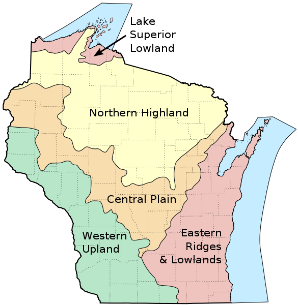
English: Map of the geographic regions of Wisconsin. |
| Date | |
| Source |
Own work based on the following sources:
|
| Author | User:Jua Cha |
| Other versions | Derivative works of this file: Wisconsin geographic provinces ru.svg |
Licensing
| I, the copyright holder of this work, release this work into the public domain. This applies worldwide. In some countries this may not be legally possible; if so: I grant anyone the right to use this work for any purpose, without any conditions, unless such conditions are required by law. |
File history
Click on a date/time to view the file as it appeared at that time.
| Date/Time | Thumbnail | Dimensions | User | Comment | |
|---|---|---|---|---|---|
| current | 14:24, 16 March 2010 | | 1,015 × 1,041 (213 KB) | commons>Jua Cha | increased border width |
File usage
There are no pages that use this file.