File:Willamette river map new.png
Jump to navigation
Jump to search
Size of this preview: 525 × 600 pixels. Other resolutions: 210 × 240 pixels | 420 × 480 pixels | 672 × 768 pixels | 896 × 1,024 pixels | 1,792 × 2,048 pixels | 2,917 × 3,333 pixels.
Original file (2,917 × 3,333 pixels, file size: 3.28 MB, MIME type: image/png)
File history
Click on a date/time to view the file as it appeared at that time.
| Date/Time | Thumbnail | Dimensions | User | Comment | |
|---|---|---|---|---|---|
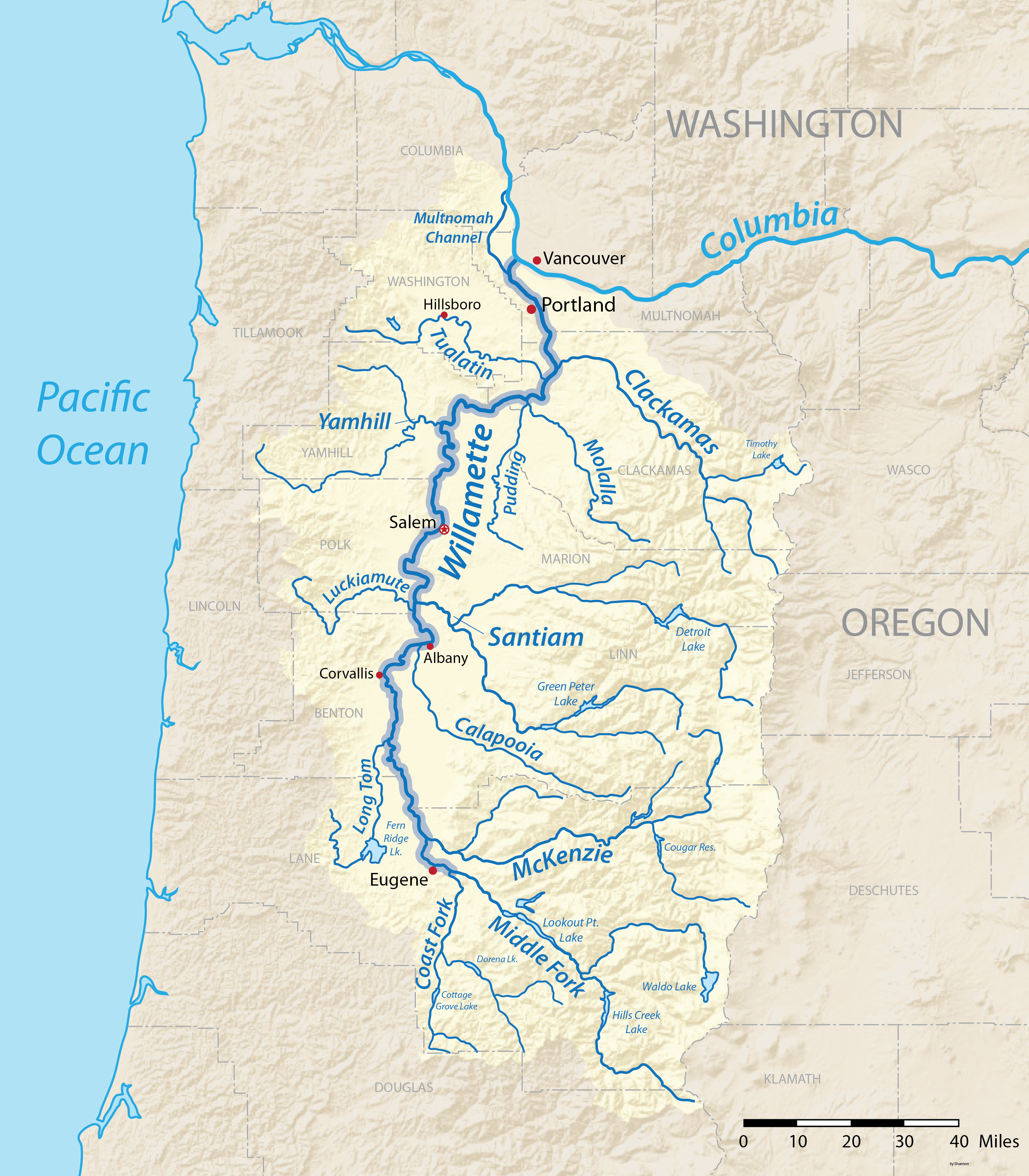
| current | 02:30, 10 March 2016 | | 2,917 × 3,333 (3.28 MB) | commons>Shannon1 | {{Information |Description ={{en|1=Map of the Willamette River Basin in Oregon, USA. Intended to replace my earlier work File:Willametterivermap.jpg}} |Source =Own work |Author =Shannon1 |Date =2016-0... |
File usage
There are no pages that use this file.