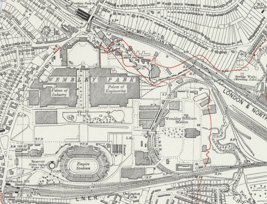
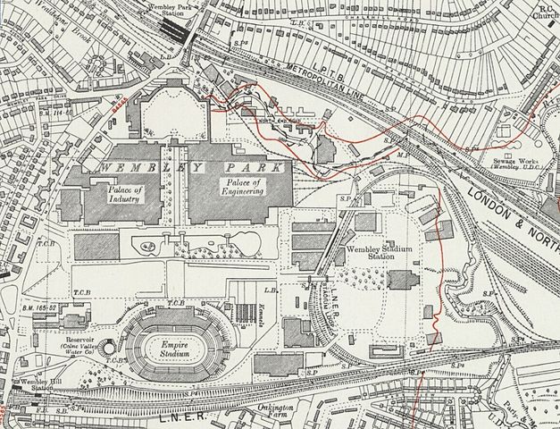
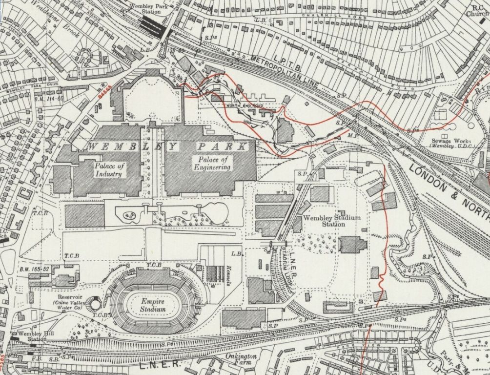
File:Wembly Park map 1938.jpg
Jump to navigation
Jump to search
Size of this preview: 783 × 599 pixels. Other resolutions: 314 × 240 pixels | 627 × 480 pixels | 1,004 × 768 pixels | 1,053 × 806 pixels.
Original file (1,053 × 806 pixels, file size: 725 KB, MIME type: image/jpeg)
File history
Click on a date/time to view the file as it appeared at that time.
| Date/Time | Thumbnail | Dimensions | User | Comment | |
|---|---|---|---|---|---|
| current | 12:03, 3 September 2016 | | 1,053 × 806 (725 KB) | commons>DavidCane | {{Information |Description={{en|1=Ordnance Survey Map of Wembley Park area, London. }} |Source=Ordnance Survey, Middlesex Sheet XI SW. Original Scale 1:10560 or Six inches to a Mile. |Author={{unknown|Author}} |Date=1938 |Permission... |
File usage
There are no pages that use this file.