File:Wassoulou map.png
Jump to navigation
Jump to search
No higher resolution available.
Wassoulou_map.png (282 × 267 pixels, file size: 34 KB, MIME type: image/png)
File history
Click on a date/time to view the file as it appeared at that time.
| Date/Time | Thumbnail | Dimensions | User | Comment | |
|---|---|---|---|---|---|
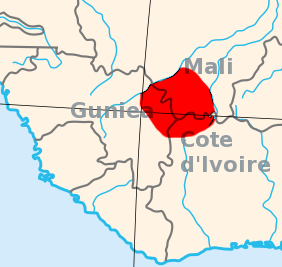
| current | 13:14, 12 January 2008 | | 282 × 267 (34 KB) | commons>File Upload Bot (Magnus Manske) | {{BotMoveToCommons|en.wikipedia}} {{Information |Description={{en|I created this, using the Gimp, and a blank area map from Wikpedia Commons, 2007-07-23. Area map of the Wassoulou (Wassulu, Wassalou, Ouassalou) region of Mali, Guinea (Guinee), Cote d'Iv |
File usage
There are no pages that use this file.