File:Warszawa Babice, CTLS D-MAKT.jpg
Jump to navigation
Jump to search

Size of this preview: 800 × 506 pixels. Other resolutions: 320 × 203 pixels | 640 × 405 pixels | 1,024 × 648 pixels | 1,280 × 810 pixels | 2,560 × 1,620 pixels | 3,294 × 2,085 pixels.
Original file (3,294 × 2,085 pixels, file size: 2.28 MB, MIME type: image/jpeg)
Summary
| Description |
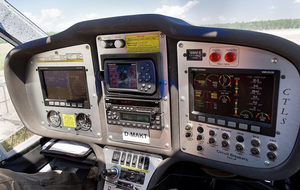
English: The cockpit of the CTLS plane made by Flight Design at Warsaw-Babice airport.
Polski: Kokpit ultralekkiego samolotu CTLS (oznaczenie boczne D-MAKT) niemieckiej firmy Flight Design, lotnisko Warszawa-Babice. |
|||||||
| Date | ||||||||
| Source | Own work | |||||||
| Author |
|
| Camera location | | View this and other nearby images on: OpenStreetMap |
|---|
Licensing
I, the copyright holder of this work, hereby publish it under the following licenses:

|
Permission is granted to copy, distribute and/or modify this document under the terms of the GNU Free Documentation License, Version 1.2 or any later version published by the Free Software Foundation; with no Invariant Sections, no Front-Cover Texts, and no Back-Cover Texts. A copy of the license is included in the section entitled GNU Free Documentation License. |
This file is licensed under the Creative Commons Attribution-Share Alike 3.0 Poland license.
- You are free:
- to share – to copy, distribute and transmit the work
- to remix – to adapt the work
- Under the following conditions:
- attribution – You must give appropriate credit, provide a link to the license, and indicate if changes were made. You may do so in any reasonable manner, but not in any way that suggests the licensor endorses you or your use.
- share alike – If you remix, transform, or build upon the material, you must distribute your contributions under the same or compatible license as the original.

You may select the license of your choice.
This file was uploaded with Commonist.
| Annotations | This image is annotated: View the annotations at Commons |

|
This image has been assessed under the valued image criteria and is considered the most valued image on Commons within the scope: Flight Design CTLS cockpit. You can see its nomination here. |
File history
Click on a date/time to view the file as it appeared at that time.
| Date/Time | Thumbnail | Dimensions | User | Comment | |
|---|---|---|---|---|---|
| current | 22:51, 10 February 2012 | | 3,294 × 2,085 (2.28 MB) | commons>CLI |
File usage
There are no pages that use this file.