File:Walna Scar Road - geograph.org.uk - 2038084.jpg
Jump to navigation
Jump to search
No higher resolution available.
Walna_Scar_Road_-_geograph.org.uk_-_2038084.jpg (640 × 427 pixels, file size: 298 KB, MIME type: image/jpeg)
Summary
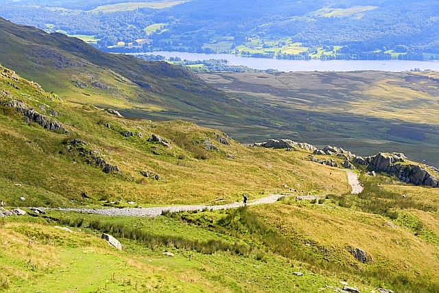
| Description |
English: Walna Scar Road. An ancient route which was often frequented by cars (before the days of modern wheels and suspensions designed for motorways). Since 2006 the route has been closed to vehicular traffic although there are appeals going through to... more |
| Date | |
| Source | From geograph.org.uk; transferred by User:Skinsmoke using geograph_org2commons. |
| Author | Mick Garratt |
| Permission (Reusing this file) |
Creative Commons Attribution Share-alike license 2.0 |
| Attribution (required by the license) | Mick Garratt / Walna Scar Road / |
| Camera location | | View this and other nearby images on: OpenStreetMap |
|---|
| Object location | | View this and other nearby images on: OpenStreetMap |
|---|
_region:GB-GBN_heading:90.00&language=en)
Licensing

|
This image was taken from the Geograph project collection. See this photograph's page on the Geograph website for the photographer's contact details. The copyright on this image is owned by Mick Garratt and is licensed for reuse under the Creative Commons Attribution-ShareAlike 2.0 license.
|
This file is licensed under the Creative Commons Attribution-Share Alike 2.0 Generic license.
Attribution: Mick Garratt
- You are free:
- to share – to copy, distribute and transmit the work
- to remix – to adapt the work
- Under the following conditions:
- attribution – You must give appropriate credit, provide a link to the license, and indicate if changes were made. You may do so in any reasonable manner, but not in any way that suggests the licensor endorses you or your use.
- share alike – If you remix, transform, or build upon the material, you must distribute your contributions under the same or compatible license as the original.
File history
Click on a date/time to view the file as it appeared at that time.
| Date/Time | Thumbnail | Dimensions | User | Comment | |
|---|---|---|---|---|---|
| current | 16:37, 9 June 2011 | | 640 × 427 (298 KB) | commons>File Upload Bot (Magnus Manske) |
File usage
There are no pages that use this file.