File:Walla Walla AVA map.JPG
Jump to navigation
Jump to search

No higher resolution available.
Walla_Walla_AVA_map.JPG (705 × 468 pixels, file size: 126 KB, MIME type: image/jpeg)
Summary
| Description |
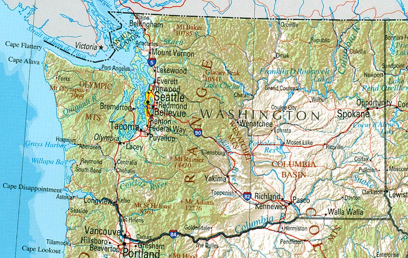
English: Modified map used to show the Walla Walla AVA within Washington State. Original public domain image locate at Perry-Castañeda Library Map Collection provided by U.S. Geological Survey 2001, printed 2002
Modified copied similarly released to public domain. |
| Source | |
| Author |
Licensing
This image is in the public domain in the United States because it only contains materials that originally came from the United States Geological Survey, an agency of the United States Department of the Interior. For more information, see the official USGS copyright policy.
|
Original upload log
The original description page was here. All following user names refer to en.wikipedia.
- 2007-06-15 03:13 Agne27 705×468×8 (129002 bytes) {{PD-USGov}} Modified map used to show the Walla Walla AVA within Washington State. Original public domain image locate at [http://www.lib.utexas.edu/maps/us_2001/washington_ref_2001.jpg Perry-Castañeda Library Map Collection] provided by [http://www.lib
File history
Click on a date/time to view the file as it appeared at that time.
| Date/Time | Thumbnail | Dimensions | User | Comment | |
|---|---|---|---|---|---|
| current | 13:11, 5 June 2008 | | 705 × 468 (126 KB) | commons>File Upload Bot (Magnus Manske) | {{BotMoveToCommons|en.wikipedia}} {{Information |Description={{en|Modified map used to show the Walla Walla AVA within Washington State. Original public domain image locate at [http://www.lib.utexas.edu/maps/us_2001/washington_ref_2001.jpg Perry-CastaÃ� |
File usage
There are no pages that use this file.