File:Wales-England Border.svg
Jump to navigation
Jump to search

Size of this PNG preview of this SVG file: 501 × 599 pixels. Other resolutions: 201 × 240 pixels | 401 × 480 pixels | 642 × 768 pixels | 857 × 1,024 pixels | 1,713 × 2,048 pixels | 512 × 612 pixels.
Original file (SVG file, nominally 512 × 612 pixels, file size: 1,024 KB)
Summary
| Description |
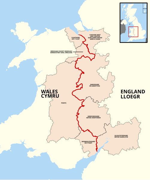
English: Map depicting the border between Wales and England, with labels of the unitary authorities along the border. |
| Date | |
| Source |
Own work This vector image includes elements that have been taken or adapted from this file: This vector image includes elements that have been taken or adapted from this file: |
| Author | Dank · Jay |
Licensing
I, the copyright holder of this work, hereby publish it under the following license:
This file is licensed under the Creative Commons Attribution-Share Alike 4.0 International license.
- You are free:
- to share – to copy, distribute and transmit the work
- to remix – to adapt the work
- Under the following conditions:
- attribution – You must give appropriate credit, provide a link to the license, and indicate if changes were made. You may do so in any reasonable manner, but not in any way that suggests the licensor endorses you or your use.
- share alike – If you remix, transform, or build upon the material, you must distribute your contributions under the same or compatible license as the original.
File history
Click on a date/time to view the file as it appeared at that time.
| Date/Time | Thumbnail | Dimensions | User | Comment | |
|---|---|---|---|---|---|
| current | 20:16, 10 October 2021 | | 512 × 612 (1,024 KB) | commons>DankJae | formatting |
File usage
There are no pages that use this file.