File:Villes assyriennes.PNG
Jump to navigation
Jump to search

Size of this preview: 800 × 578 pixels. Other resolutions: 320 × 231 pixels | 640 × 462 pixels | 1,024 × 740 pixels | 1,117 × 807 pixels.
Original file (1,117 × 807 pixels, file size: 1.3 MB, MIME type: image/png)
File history
Click on a date/time to view the file as it appeared at that time.
| Date/Time | Thumbnail | Dimensions | User | Comment | |
|---|---|---|---|---|---|
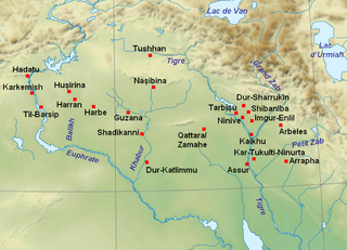
| current | 19:53, 22 September 2010 | | 1,117 × 807 (1.3 MB) | commons>Zunkir | {{Information |Description={{en|1=Map with the main cities of Assyria and Upper Mesopotamia during the medio-assyrian (ca. 1365-934 BC) and neo-assyrian period (ca. 934-609 BC).}} {{fr|1=Localisation des principales villes de l'Assyrie et de la Haute Més |
File usage
There are no pages that use this file.