File:Vancouver map 13June1886.jpg
Jump to navigation
Jump to search

Size of this preview: 798 × 599 pixels. Other resolutions: 320 × 240 pixels | 639 × 480 pixels | 1,022 × 768 pixels | 1,210 × 909 pixels.
Original file (1,210 × 909 pixels, file size: 273 KB, MIME type: image/jpeg)
File history
Click on a date/time to view the file as it appeared at that time.
| Date/Time | Thumbnail | Dimensions | User | Comment | |
|---|---|---|---|---|---|
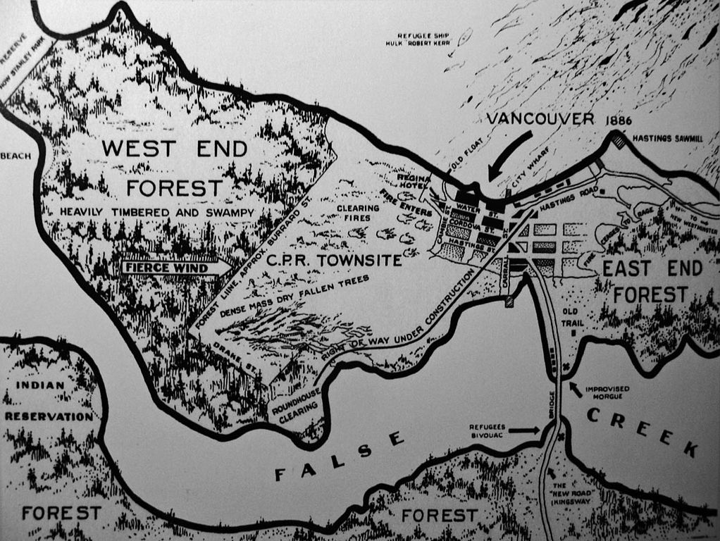
| current | 03:10, 8 March 2007 | | 1,210 × 909 (273 KB) | commons>Bobanny | Map of Vancouver fire, 1886, drawn in the 1930s by JS Mathews based on first hand accounts. From a reproduction in Derek Hayes, "Historical Atlas of Vancouver and the Lower Fraser Valley" (Vancouver: Douglas & McIntyre, 2005), p. 52. {{PD-old-50}} |
File usage
There are no pages that use this file.