File:Vancouver1798map-SanJuan-Gulf.png
Jump to navigation
Jump to search
Size of this preview: 521 × 599 pixels. Other resolutions: 209 × 240 pixels | 417 × 480 pixels | 766 × 881 pixels.
Original file (766 × 881 pixels, file size: 1.39 MB, MIME type: image/png)
File history
Click on a date/time to view the file as it appeared at that time.
| Date/Time | Thumbnail | Dimensions | User | Comment | |
|---|---|---|---|---|---|
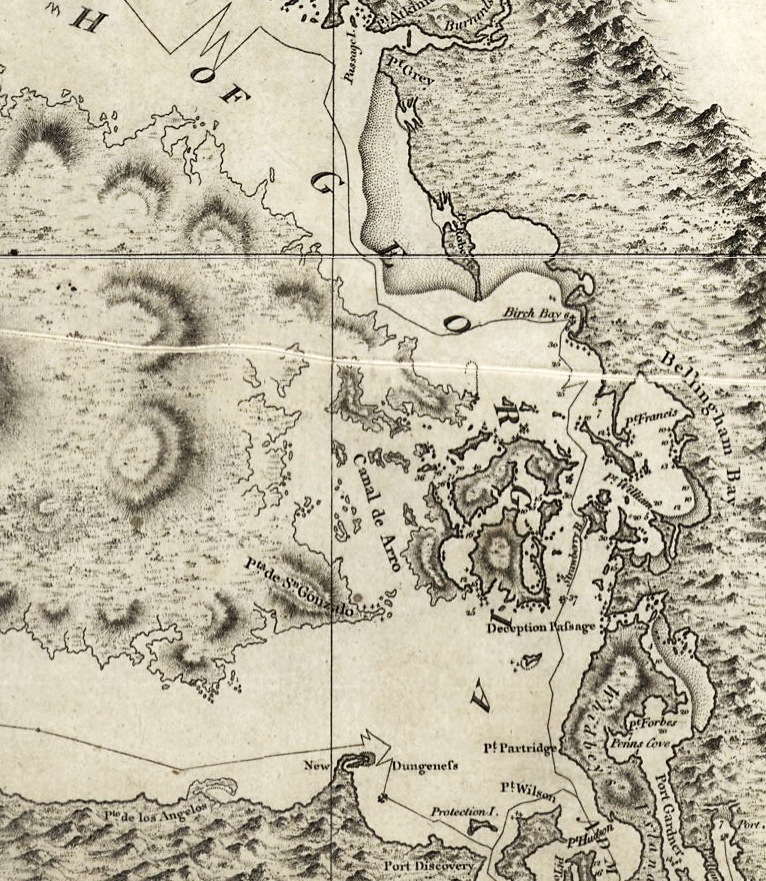
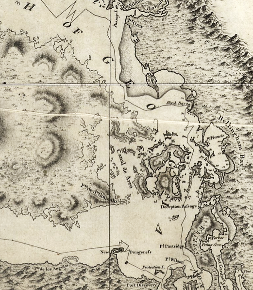
| current | 06:42, 16 May 2008 | | 766 × 881 (1.39 MB) | commons>Pfly | {{Information |Description=Excerpt of a map by George Vancouver, titled "A chart shewing part of the coast of N.W. America : with the tracks of His Majesty's sloop Discovery and armed tender Chatham / commanded by George Vancouver, Esqr. and prepared unde |
File usage
There are no pages that use this file.