File:VA 199 map.svg
Jump to navigation
Jump to search

Size of this PNG preview of this SVG file: 800 × 471 pixels. Other resolutions: 320 × 188 pixels | 640 × 377 pixels | 1,024 × 603 pixels | 1,280 × 753 pixels | 2,560 × 1,506 pixels | 1,205 × 709 pixels.
Original file (SVG file, nominally 1,205 × 709 pixels, file size: 1.05 MB)
File history
Click on a date/time to view the file as it appeared at that time.
| Date/Time | Thumbnail | Dimensions | User | Comment | |
|---|---|---|---|---|---|
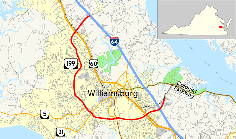
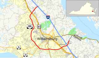
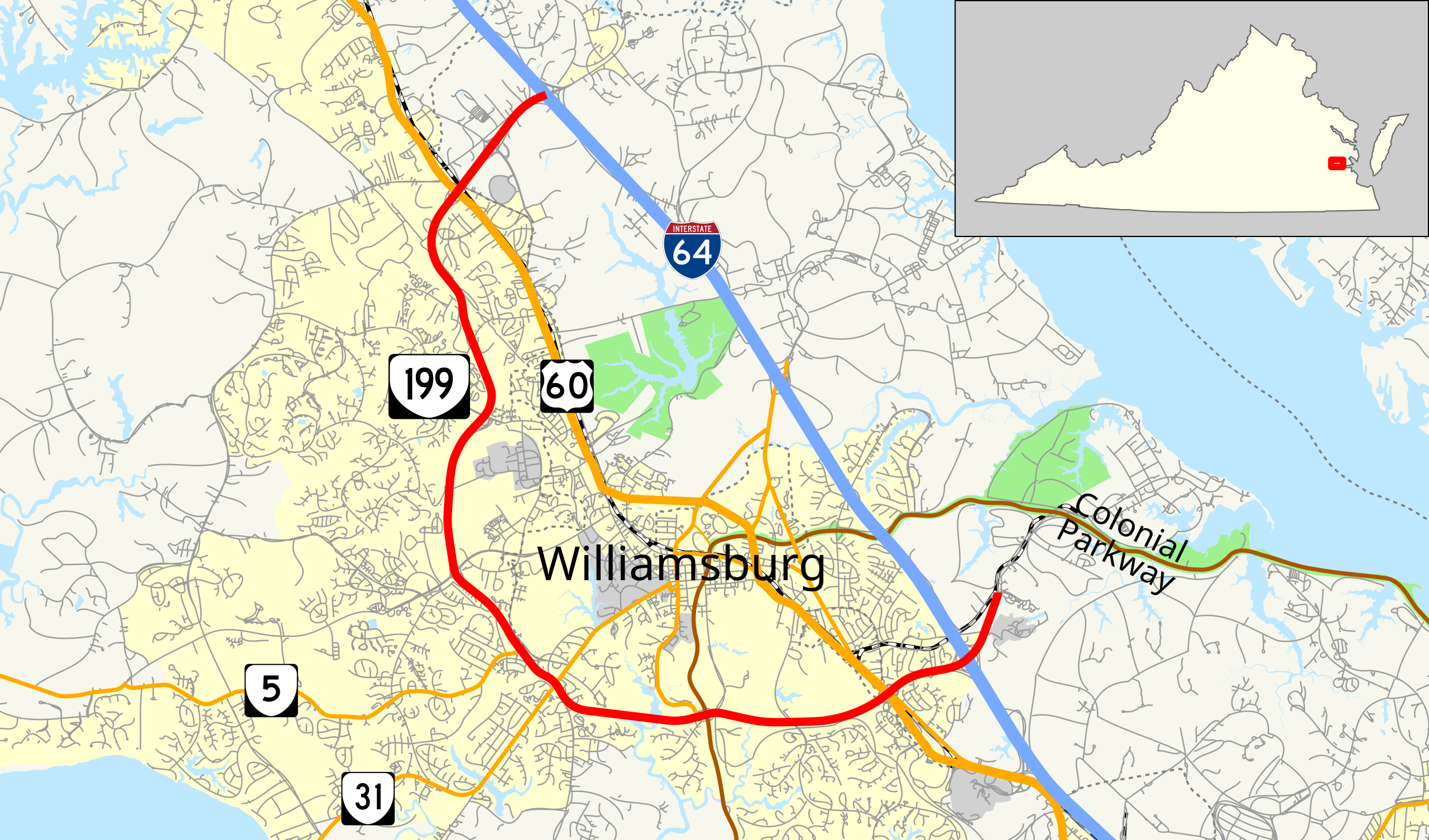
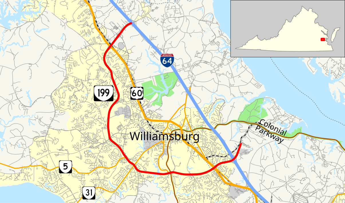
| current | 00:42, 21 June 2014 | | 1,205 × 709 (1.05 MB) | commons>Mr. Matté | =={{int:filedesc}}== {{Information |Description=Map of w:Virginia State Route 199 |Source={{own}}, data from [http://www.census.gov/cgi-bin/geo/shapefiles2012/main U.S. Census Bureau] {{inkscape}} {{QGIS}} |Date=2014-06-20 |Author={{User:Mr. Matt... |
File usage
There are no pages that use this file.