File:United Kingdom - location map.png
Jump to navigation
Jump to search

Size of this preview: 388 × 600 pixels. Other resolutions: 155 × 240 pixels | 310 × 480 pixels | 885 × 1,368 pixels.
Original file (885 × 1,368 pixels, file size: 132 KB, MIME type: image/png)
File history
Click on a date/time to view the file as it appeared at that time.
| Date/Time | Thumbnail | Dimensions | User | Comment | |
|---|---|---|---|---|---|
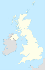
| current | 23:05, 28 January 2010 | | 885 × 1,368 (132 KB) | commons>Hogweard | == {{int:filedesc}} == {{Information |Description= {{en|Location map of the en:United Kingdom}} {{fr|Carte de location du fr:Royaume Uni}} Equirectangular projection, N/S stretching 170 %. Geographic limits of the map: * N: 61.0° N * S: 49.0° N |
File usage
There are no pages that use this file.