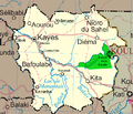
File:Un-mali Kayes Region.png
Jump to navigation
Jump to search
Un-mali_Kayes_Region.png (692 × 594 pixels, file size: 208 KB, MIME type: image/png)
File history
Click on a date/time to view the file as it appeared at that time.
| Date/Time | Thumbnail | Dimensions | User | Comment | |
|---|---|---|---|---|---|
| current | 18:42, 4 March 2008 |  | 692 × 594 (208 KB) | commons>T L Miles | {{Information |Description=Map of the Kayes Region of Mali. Additions include new northern road via Diema, several towns, downgrade of road (in fact unpaved) from Kayes to Kenieba. Solid pink lines are paved, dashed are unpaved. Addition of National pa |
File usage
There are no pages that use this file.
