File:US insular areas FAS.png
Jump to navigation
Jump to search

Size of this preview: 800 × 337 pixels. Other resolutions: 320 × 135 pixels | 640 × 269 pixels | 1,482 × 624 pixels.
Original file (1,482 × 624 pixels, file size: 32 KB, MIME type: image/png)
File history
Click on a date/time to view the file as it appeared at that time.
| Date/Time | Thumbnail | Dimensions | User | Comment | |
|---|---|---|---|---|---|
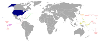
| current | 05:00, 5 March 2008 | | 1,482 × 624 (32 KB) | commons>Hoshie | == Summary == This is a map of the US Insular areas with the freely associated states of the Marshall Islands, Palau, and the Federated States of Micronesia (according to the [http://www.doi.gov/oia/Islandpages/political_types.htm US Office of Insular Af |
File usage
There are no pages that use this file.