File:USGS Shakemap - 1999 Izmit earthquake.jpg
Jump to navigation
Jump to search
Size of this preview: 510 × 599 pixels. Other resolutions: 204 × 240 pixels | 612 × 719 pixels.
Original file (612 × 719 pixels, file size: 158 KB, MIME type: image/jpeg)
Summary
| Description |
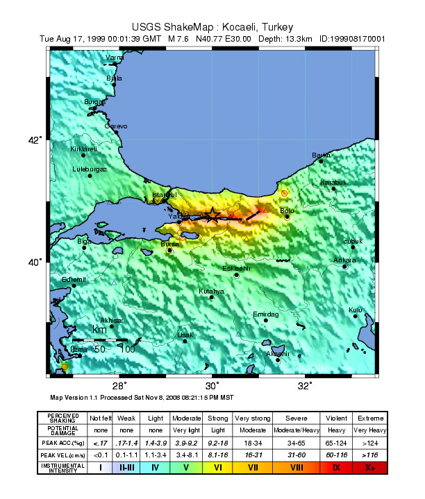
English: Shake map showing intensity of shaking during the 1999 Izmit earthquake |
| Date | |
| Source | [1] |
| Author | USGS |
![[1]](https://earthquake.usgs.gov/earthquakes/shakemap/atlas/shake/199908170001/download/intensity.jpg)
Licensing
This image is in the public domain in the United States because it only contains materials that originally came from the United States Geological Survey, an agency of the United States Department of the Interior. For more information, see the official USGS copyright policy.
|
File history
Click on a date/time to view the file as it appeared at that time.
| Date/Time | Thumbnail | Dimensions | User | Comment | |
|---|---|---|---|---|---|
| current | 03:54, 15 March 2013 | | 612 × 719 (158 KB) | commons>Dawnseeker2000 | User created page with UploadWizard |
File usage
There are no pages that use this file.