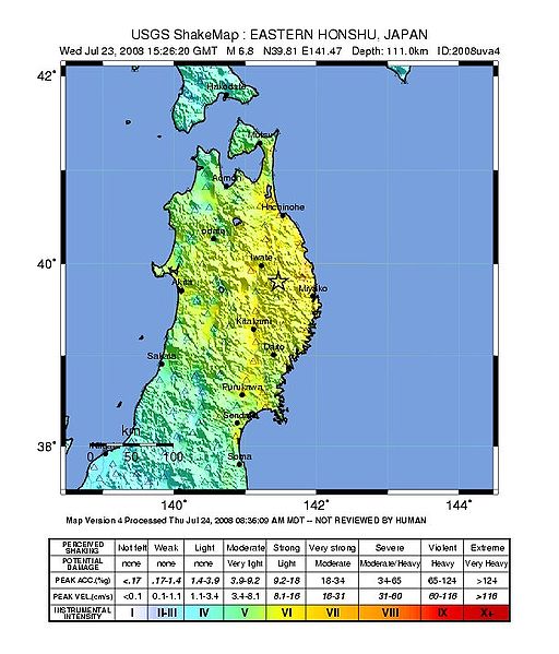
File:USGS ShakeMap 2008uva4.jpg
Jump to navigation
Jump to search

Size of this preview: 512 × 599 pixels. Other resolutions: 205 × 240 pixels | 612 × 716 pixels.
Original file (612 × 716 pixels, file size: 88 KB, MIME type: image/jpeg)
File history
Click on a date/time to view the file as it appeared at that time.
| Date/Time | Thumbnail | Dimensions | User | Comment | |
|---|---|---|---|---|---|
| current | 16:06, 24 July 2008 | | 612 × 716 (88 KB) | commons>新鳩244号 | USGS ShakeMap : EASTERN HONSHU, JAPAN<br />Wed Jul 23, 2008 15:26:20 GMT M 6.8 N39.81 E141.47 Depth: 111.0km ID:2008uva4<br />Map Version 4 Processed Thu Jul 24, 2008 08:36:09 AM MDT -- NOT REVIEWED BY HUMAN Category:Earthquakes of 2008 |
File usage
There are no pages that use this file.