File:USA Washington Metropolitan Area location map.svg
Jump to navigation
Jump to search

Size of this PNG preview of this SVG file: 172 × 193 pixels. Other resolutions: 214 × 240 pixels | 428 × 480 pixels | 684 × 768 pixels | 913 × 1,024 pixels | 1,825 × 2,048 pixels.
Original file (SVG file, nominally 172 × 193 pixels, file size: 72 KB)
Summary
| Description |
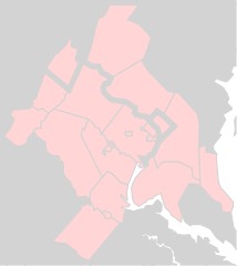
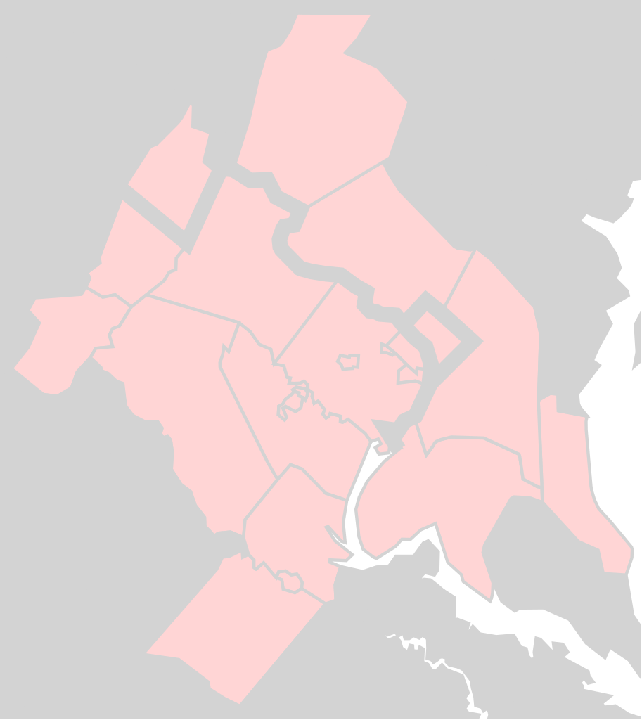
English: Washington Metropolitan Area as defined by 47900 DC-VA-MD-WV Metropolitan Statistical Area |
| Date | |
| Source | File:Usa_counties_large.svg |
| Author | Federal Government |
| SVG development |
Licensing
This work is in the public domain in the United States because it is a work prepared by an officer or employee of the United States Government as part of that person’s official duties under the terms of Title 17, Chapter 1, Section 105 of the US Code.
Note: This only applies to original works of the Federal Government and not to the work of any individual U.S. state, territory, commonwealth, county, municipality, or any other subdivision. This template also does not apply to postage stamp designs published by the United States Postal Service since 1978. (See § 313.6(C)(1) of Compendium of U.S. Copyright Office Practices). It also does not apply to certain US coins; see The US Mint Terms of Use.
|
 | |
| This file has been identified as being free of known restrictions under copyright law, including all related and neighboring rights. | ||
File history
Click on a date/time to view the file as it appeared at that time.
| Date/Time | Thumbnail | Dimensions | User | Comment | |
|---|---|---|---|---|---|
| current | 18:08, 21 March 2017 | | 172 × 193 (72 KB) | commons>Id4abel | Thick black lines made text impossible to read. |
File usage
There are no pages that use this file.