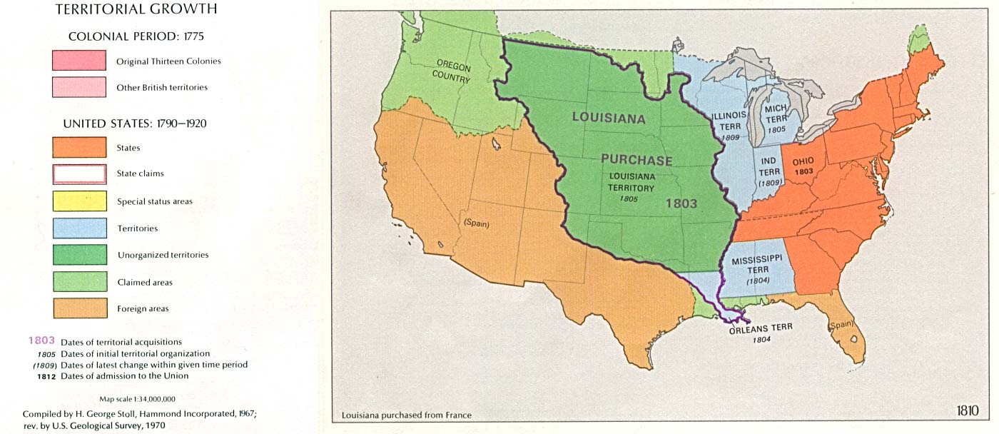
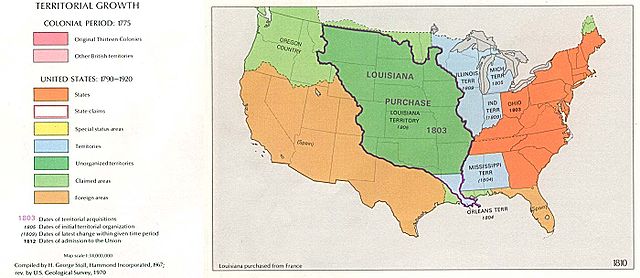
File:USA Territorial Growth 1810.jpg
Jump to navigation
Jump to search
Size of this preview: 800 × 347 pixels. Other resolutions: 320 × 139 pixels | 640 × 278 pixels | 1,400 × 608 pixels.
Original file (1,400 × 608 pixels, file size: 119 KB, MIME type: image/jpeg)
File history
Click on a date/time to view the file as it appeared at that time.
| Date/Time | Thumbnail | Dimensions | User | Comment | |
|---|---|---|---|---|---|
| current | 00:52, 19 January 2005 | | 1,400 × 608 (119 KB) | commons>Exdaix | 1970 USGS map {{PD-USGov-USGS}} |
File usage
There are no pages that use this file.